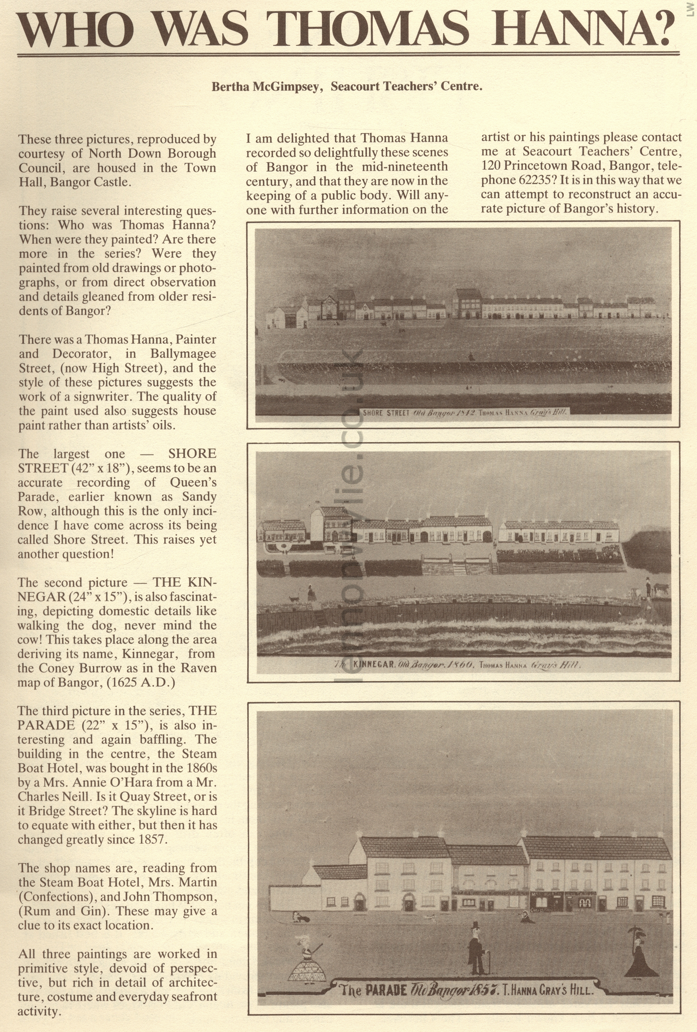
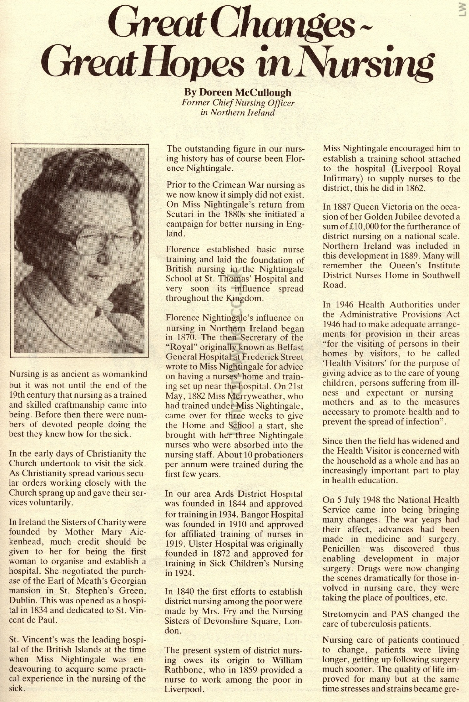
|
Bangor Lot 04
Postcards - Photos (lots of photos) - Booklets
- Miscellaneous
Page Two -
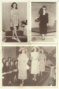
Photographs
Postcards


1
2
3
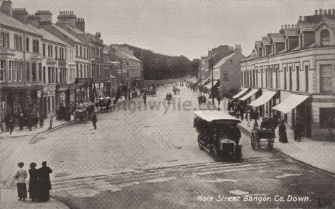
1) 'Main Street, Bangor' 27th July 1931 Postmark Bangor to Mrs. L.
Seabrooke, 50 East Street, Donaghadee - Dear L., Just a line hoping you are
all keeping well, glad to say we are. Sorry we can't have you all over here
for an afternoon but the place is crowded out. Be sure & come up to see us
at home next Sunday as Lily will be leaving for America on Friday 7th
August. She has made up her mind all at once. They will be fairly busy next
week getting things ready for her for the journey. Best love from Auntie,
George? & your loving uncle Harry?
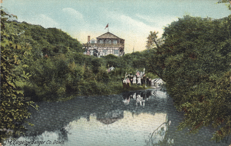
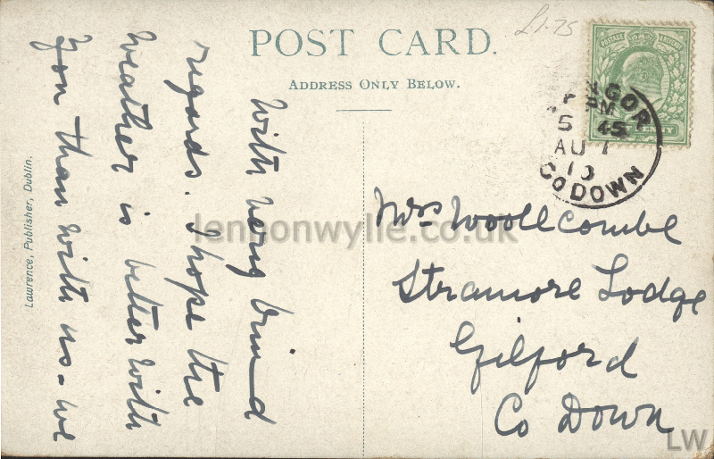
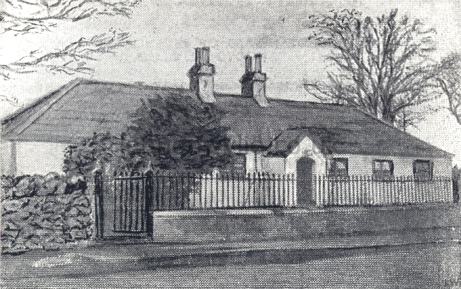
2) 'The Bungalow, Bangor' 7th August 1910? Postmark Bangor to Mrs.
Woolecombe, Stramore Lodge, Gilford, Co. Down - With very kind regards. I
hope the weather is better with you than with us - wl?
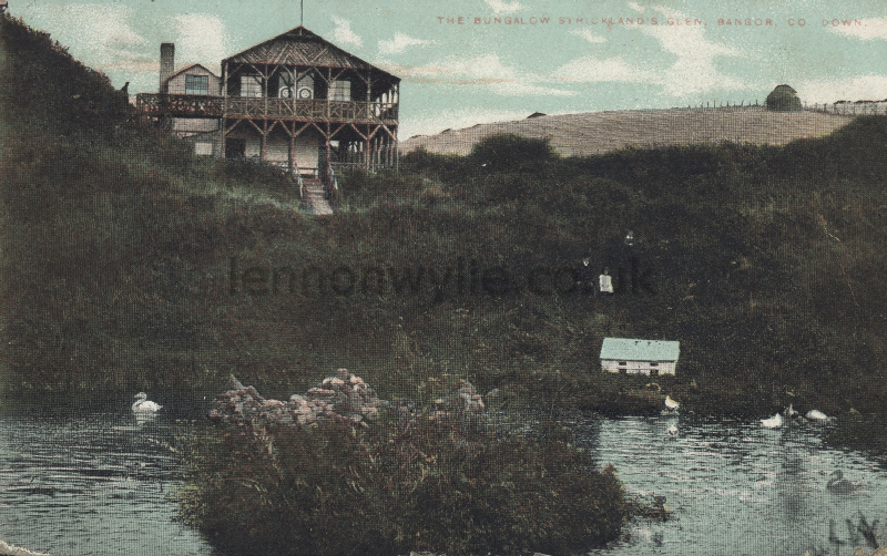
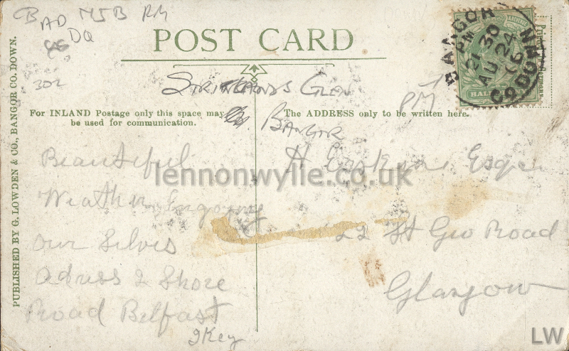
3) 'The Bungalow, Strickland's Glen, Bangor' 24th August 1906 Postmark
Bangor to H. Eastman? Esq., 22? St. Geo. Road, Glasgow - Beautiful weather,
enjoying ourselves. Adress 2 Shore Road, Belfast J. Key?
1
2
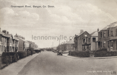
1) 'Groomsport Road, Bangor' 24th August 1932 Postmark
Bangor to Mrs. Steele, Grange Road, Ballymena - 24/8/32 My dear
Mother, Aunt Minnie Uncle G. & Lil are going to Dublin tomorrow, so I have
to stay in charge. I shall be home Friday night. Hope man??s are big. Love
to all Jack
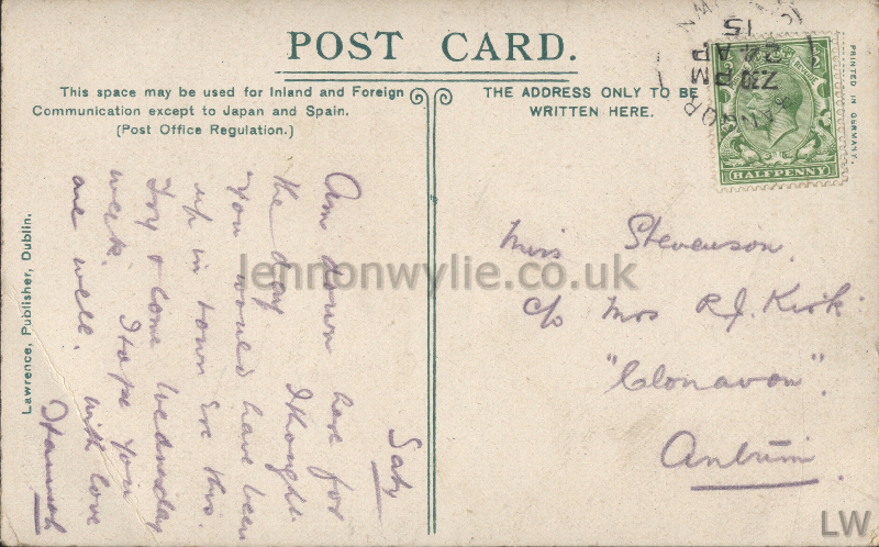
2) 'Main Street, Bangor' 24th April 1915 Postmark Bangor to Miss Stevenson,
c/o Mrs. R. J. Kirk, "Clonavon" Antrim - Saty. Am down here for the
day. I thought you would have been up in town ? this. Try & come Wednesday
week. I hope you are well. with love Hannah or Hamish or Harriet?
1
2
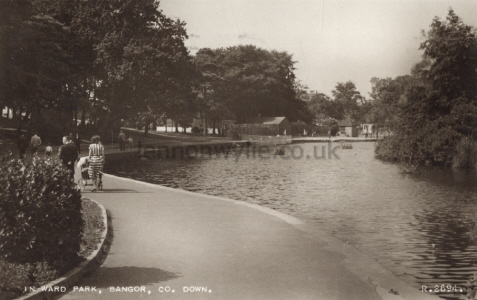
1) 'In Ward Park, Bangor' 13th July 1953 Postmark Bangor to Mr. & Mrs. Rea?,
143 Ballygomartin Road, Belfast, N.I. - Hello - Jean & Jimmy. Weather here
not so good. Mr. McCleery said we would be as well in Woodvale Park. Cheerio
Gilbert
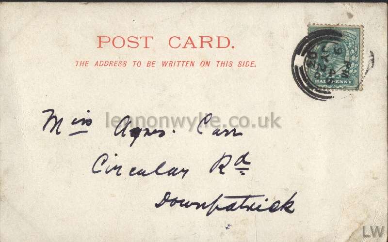
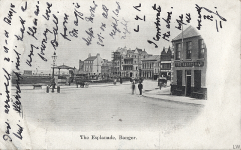
2) 'The Esplanade, Bangor' 26th July 1903 Postmark ? to Miss Agnes Carr,
Circular Road, Downpatrick - Just arrived - - - - Warrenpoint, had a very
pleasant journey, love to all from Maggie, hope Mother got on all right last
night. ??? I corroborate the above, hope all are well. K.? J.

1
2
3
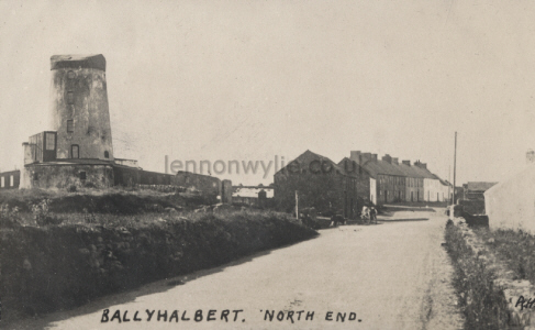
1) 'Ballyhalbert, North End' 18th August 1925 Postmark Kircubbin to Mrs.
Hugh Stevenson, Ballywoodock, Templepatrick, Co. Antrim - Glastry Manse.
This is a view of one end of the village. We are all well and enjoying
ourselves. I hope you are all keeping well. I thought I would have heard
from Martha before now. James is very well & in good form. He can work in
the house as good as Willie. We had a letter from Sam? this morning. They
seem to be enjoying Portstewart. With love to all Hannah
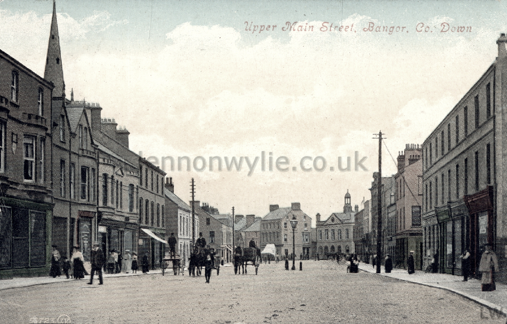
2) 'Upper Main Street, Bangor'
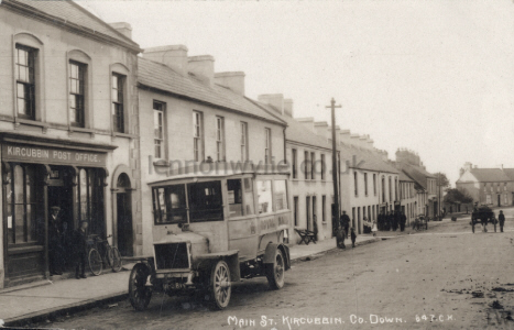
3) 'Main Street, Kircubbin' (Kircubbin Post Office, Royal Mail)

Seacliffe Road, The Long/Big Hole, Bangor
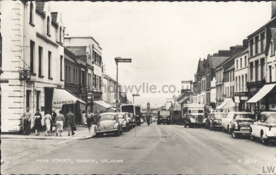
Main Street, Bangor (Warner's Shoes; A.A. Hotel)


Grey Point, Bangor, from Seacourt
across from The Windsor Bar (Marine Bar
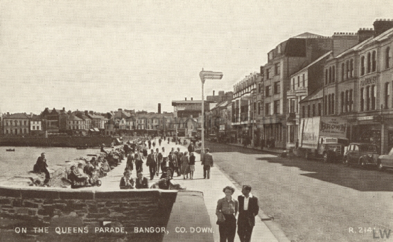
On The Queens Parade, Bangor
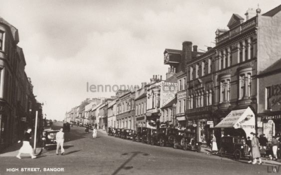
High Street, Bangor


Connor's Point, Bangor
Queen's Parade, Bangor (Regent Palace Hotel)
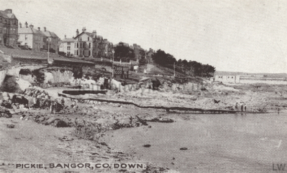

Pickie, Bangor
The Walk to Carnalea, Bangor
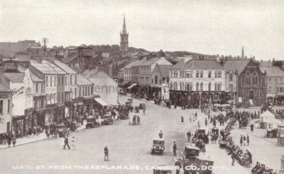
Main Street from the Esplanade, Bangor (Central Cafe)
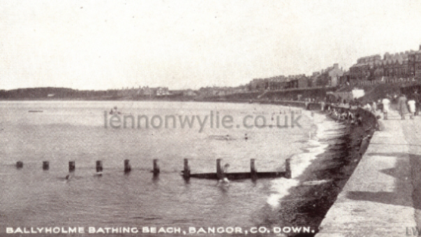
Ballyholme Bathing Beach, Bangor

Mount Pleasant, Bangor
The Mill Pool, J. W. Richie?? 1917 With all good wishes for Christmas &
Prosperous ? New Year. ? Ruther? Butler?
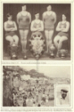
Miscellaneous


1
2
3
4
5
6
7
8
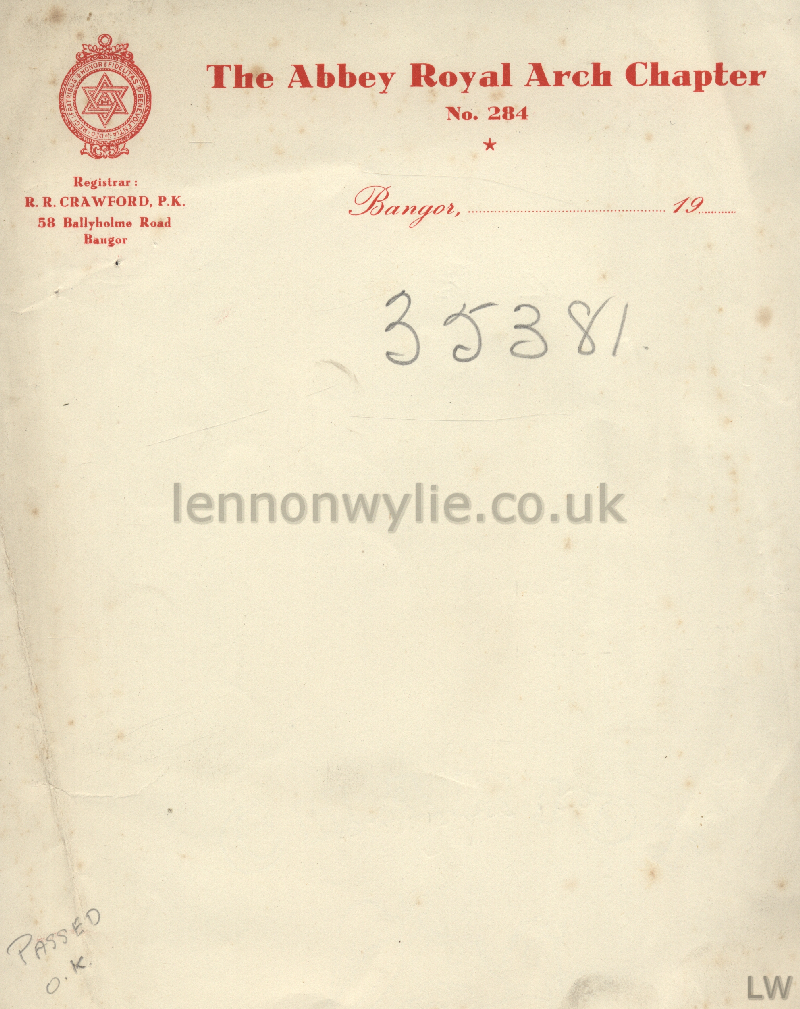
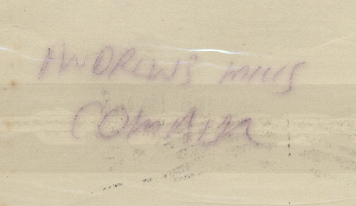
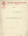
1) R. R. Crawford, P.K., 58 Ballyholme Road, Bangor - The Abbey Royal Arch
Chapter - Andrews Mills, Comber
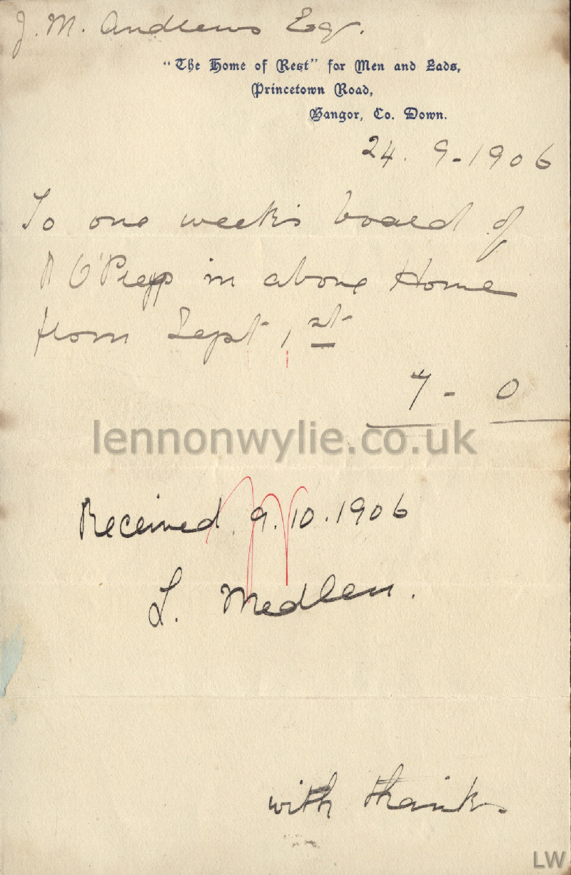
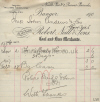
2) 24-9-1906 J. M. Andrews, Esq. "The Home of Rest" for Men and Lads,
Princetown Road, Bangor - To one weeks board of ? O'Prey in above Home from
Sept. 1st. 7-0 - Received 9.10.1906 L. Medle? with thanks - Home of Rest
3) 1906 Neill's Pier, Queen's Parade, Bangor Mess. John Andrews & Co.,
Comber, Robert Neill & Sons.
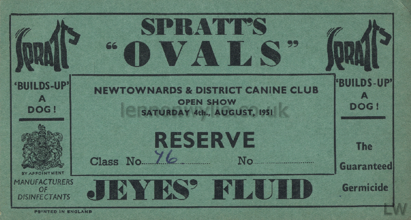
4) Newtownards & District Canine Club open show Saturday 4th August 1951
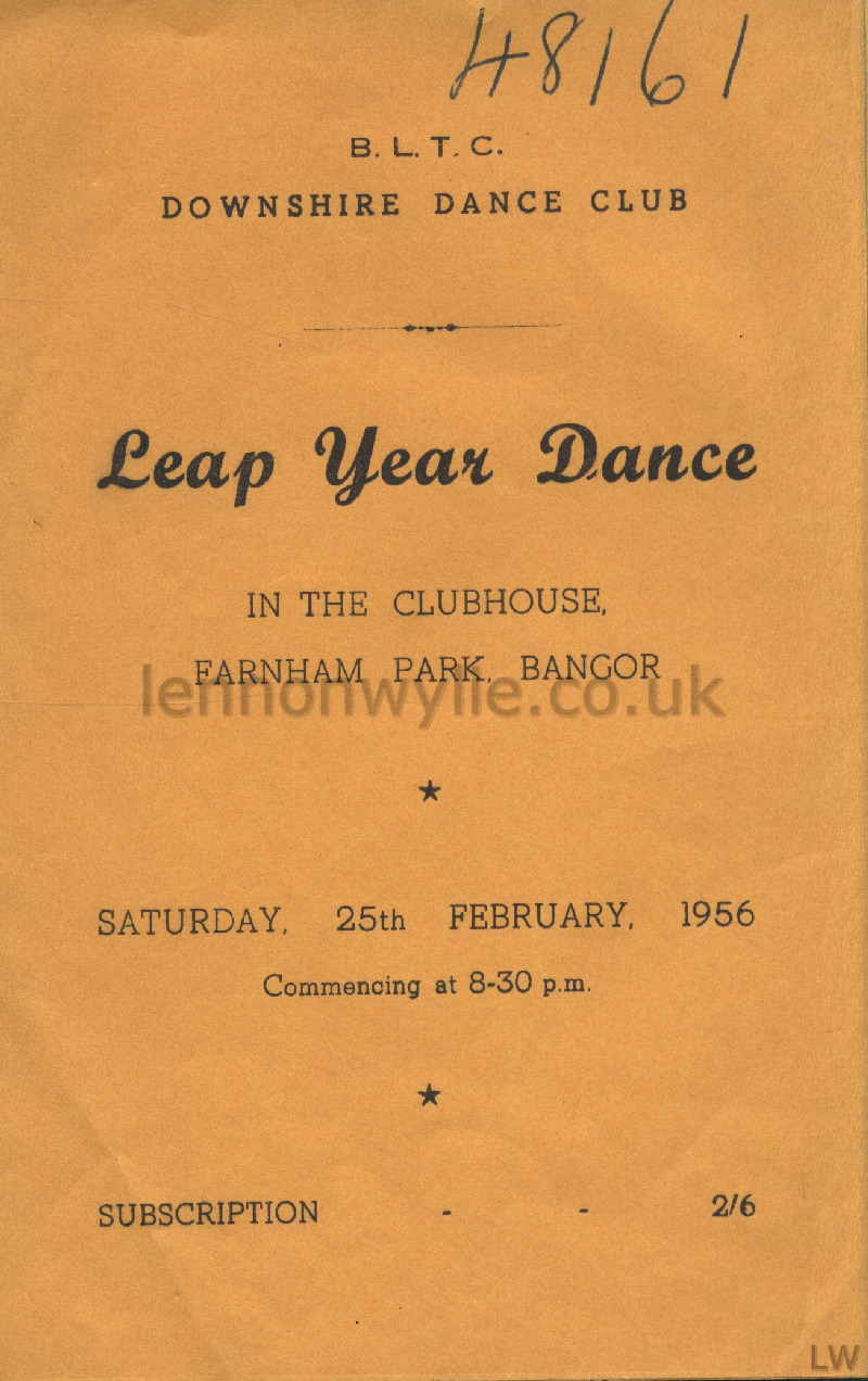
5) B.L.T.C. Downshire Dance Club, Leap Year Dance in the Clubhouse, Farnham
Park, Bangor, Saturday 25th February 1956
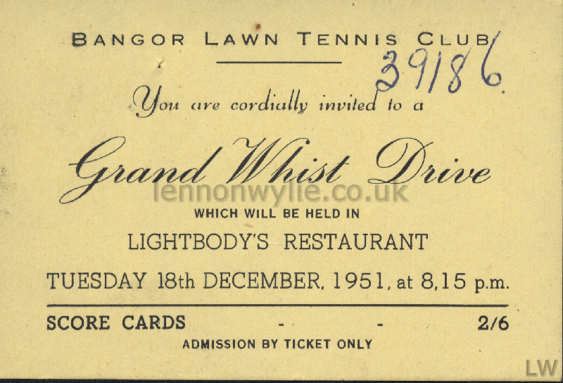
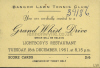
6) Bangor Lawn Tennis Club Grand Whist Drive, Lightbody's Restaurant,
Tuesday 18th December 1951
7) Bangor Lawn Tennis Club, Farnham Park, Dance in the Clubhouse, Easter
Monday April 14th 1952
8) Bangor Lawn Tennis Club, Dress Dance, 30th November 1951
1
2
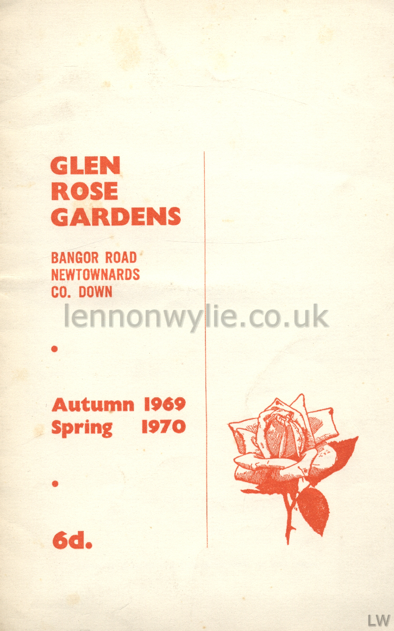
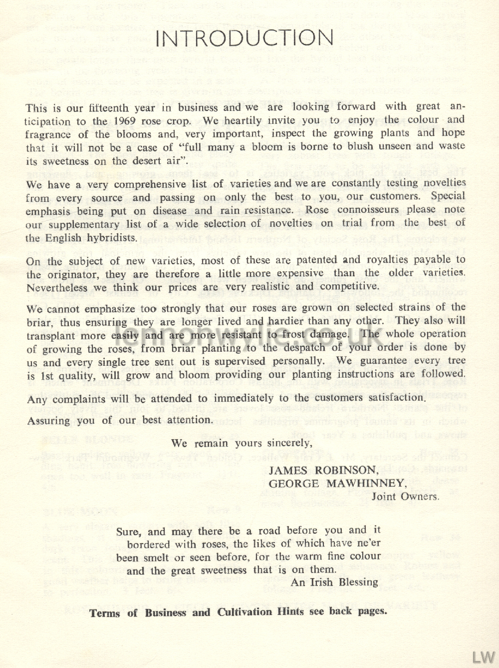
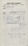
1) Glen Rose Garden, Bangor Road, Newtownards 1969/70 - Invoice for roses,
planted by Dave Steele Saturday 25th October 1969 - James Robinson, George
Mawhinney, joint owners
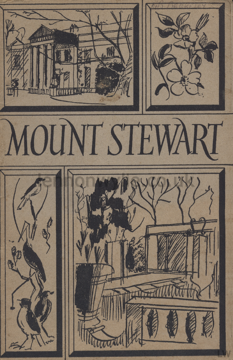
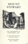
2) Mount Stewart, Noel Andrews, 1953
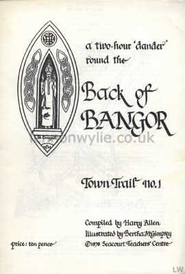 
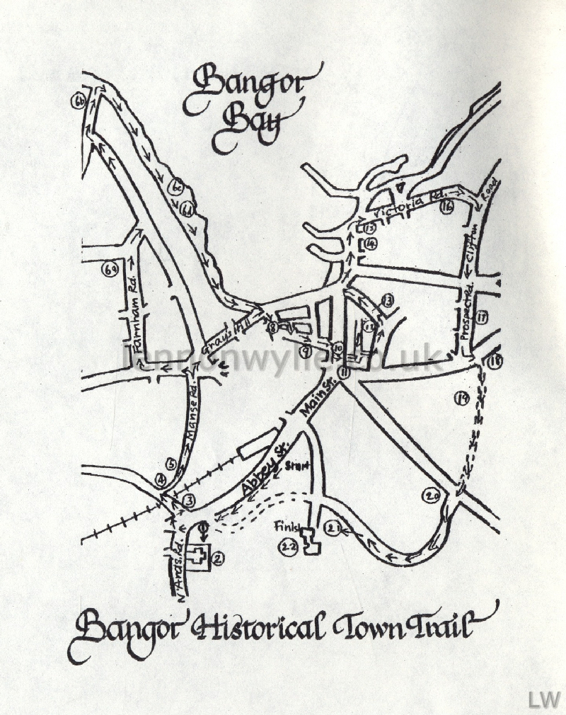
a two-hour 'dander' round the Back of Bangor - Town Trait No. 1
Compiled by Harry Allen, Illustrated by Bertha McGimpsey - Seacourt
Teachers' Centre
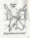
Bangor Historical Town Trail
The Back of Bangor - A Two Hour 'Dander' Round Some of the Interesting Old
Places in the Town
For
fourteen centuries there has been some kind of settlement at Bangor. It
is unlikely ever to have been very large. Indeed, according to Harris in
1744, there were only 200 houses in the town. Even as recently as 1861,
Bangor's population was smaller than either of its coastal neighbours -
Holywood and Donaghadee, and, unlike both of these towns, was still
unconnected by rail with Belfast. What really seems to have started
Bangor's growth was the establishment of Commissioners after the Towns'
Improvements Act of 1854. Most of modern Bangor's subsequent development
is a result of the determination of these Commissioners to make Bangor a
prosperous residential town.
This little guide is an attempt to point out some of
the places of interest which might give a flavour of Bangor's past. The
trail can be walked in one outing or split into parts. This guide does
not try to mention everything - in fact some features along the way have
been deliberately left out or else very sparingly described in order to
give you, the walker, the pleasure of discovery. The emphasis is
unashamedly historical. If what you see excites your interest, further
information can be found in inexpensive publications such as:
Victoria Bangor edited by Grenfell Morton
My Bangor by Charles Milligan
Guide to Bangor 1885 by W. G. Lyttle
or from the Bangor Historical Society, c/o Seacourt, Princetown Road. -
(https://www.bangorhistoricalsocietyni.org)
It is hoped that there will soon be companion Trail
Guides, such as 'The Front of Bangor', dealing with the main
thoroughfares in the town, which have mostly been omitted from this
guide: the 'Edge of Bangor', describing points of interest a little
further flung than those described here - places such as Ballyholme,
Rathgael and Carnalea.
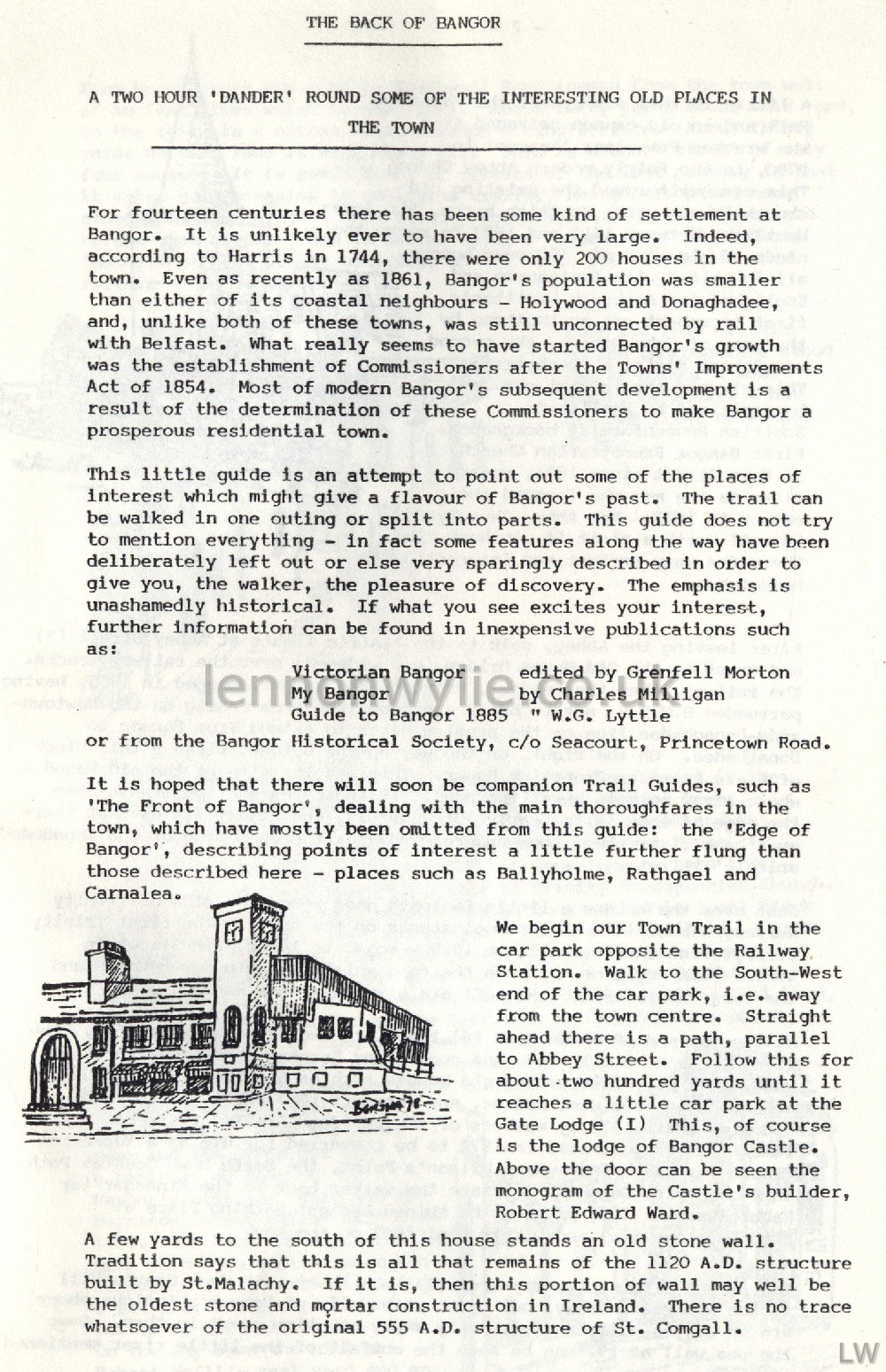
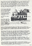
We begin our Town Trail in the car park opposite the
Railway Station. Walk to the South-West end of the car-park, i.e. away
from the town centre. Straight ahead there is a path, parallel to Abbey
Street. Follow this for about two hundred yards until it reaches a
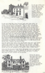
little car park at the Gate Lodge (1) This, of course is the lodge of
Bangor Castle. Above the door can be seen the monogram of the Castle's
builder, Robert Edward Ward. A few yards to the south of this
house stands an old stone wall. Tradition says that this is all that
remains of the 1120 A.D. structure built by St. Malachy. If it is, then
this portion of wall may well be the oldest stone and mortar
construction in Ireland. There is no trace whatsoever of the original
555 A.D. structure of St. Comgall.
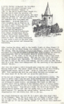
A little further south, past the parochial Hall and an
old canon salvaged from the wrecked Privateer 'Amazon' in 1780, is the
fairly modern Abbey Church (2). This was built round the existing old
church tower by the Scottish baron, Sir James Hamilton, between 1613 and
1623 to serve the needs of his town of '80 newe houses, all inhabited
with Scotyshmen and Englishmen'. Although Hamilton's first incumbent was
an Anglican by the name of John Gibson, the second was Robert Blair, a
Presbyterian. This strange appointment can be explained by Hamilton's
Scottish Nonconformist background. First Bangor Presbyterian Church, in
Main Street since 1831; regard Blair as the man who founded their church
in 1623. The Abbey Churchyard is well worth a visit if you have time.
There are many ancient and interesting headstones.
After leaving the Abbey, walk to the traffic lights at
Abbey Street (3) and cross to the Old Boyne Bridge (now widened) over
the railway tracks. The railway, then the Belfast, Holywood and Bangor,
opened in 1865, having persuaded B.C.D.R. not to build a branch line
from Conlig on the Newtownards-Donaghadee line on the promise never to
extend from Bangor to Donaghadee. On the right, on the way up to the
bridge, rises a tall block of flats known as Brunswick Manor. This was
the site of the old Pound - where stray animals were impounded. It
indicates what must have been the edge of town in the early 19th
Century, and also tells us that there must be a river there (now
underground) for the quenching of the impounded animals thirsts.
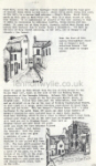
Just over the bridge a little footpath goes round the
side of Trinity Nursery School (4). The school stands on the site of the
first Trinity Presbyterian Church, built in 1829 - moved to lower Main
Street in 1889. This explains why both the road which the path now
becomes and the large house (5) to the left are given the name Manse.
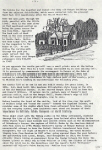
At the far end of Manse Road (6) there are two alternative routes. The
first is about a mile long and goes along Farnham Road and Princetown
Road, past many interesting old houses such as Seaview (5a), which is
one of Bangor's oldest houses, and Seacourt (6b) built in 1865 and
occupied until 1972 by members of the Davidson family of Sirocco Works
fame. It was purchased in 1972 to be converted for use as a Teachers'
Centre for the area. From Wilson's Point, the North Down Coastal Path
through Marine Gardens will take the walker back to the Kinnegar (Rabbit
Warren) (7), passing the ruined Ladies' Bathing Place at Skippingstone
(6c) and Pickie Pool (6d) on the way. The second alternative way
from (6) us a short walk down Gray's Hill to the Kinnegar. Many, but by
no means all, of Bangor's Antique shops are on Gray's Hill, and may
amply repay any time spent in them. Over the sea wall at (7) can be seen
the outfall of the little river mentioned earlier.
From here, cross the road to Southwell Road (named from
the town well of ancient times which is now lost). About fifty yards
along this road, on the left, is a narrow lane entrance - King's Place.
About thirty yards up this lane is West Place (8). This is a short
street of only four houses. It is reminiscent of streets of the last
century in that it makes no concession to vehicular traffic, being
narrow and one-sided. It comes out at King Street, formerly called West
Street and before that Souters' Row (a souter being a shoemaker). (9)
Walk up the hill of King Street noticing, on the left, one of Bangor's
old streets - the Vennel. Near the foot of this narrow thoroughfare
stood one of Bangor's most notorious houses - but its red light no
longer glows.
About 50 yards up Main Street from the top of King
Street is the Ulster Bank (10), built on the site of the old Reading
Rooms, predecessor of the Carnegie Library. Between this bank and the
Northern Bank (11), housed in the old Georgian Markey House, is Bingham
Lane. Follow this lane past the undertakers, turn left and go straight
on as far as the rear of Trinity Presbyterian Church. On your right is a
large, gaunt building constructed in local black stone and red brick.
This was Bangor's Cholera House (12) - a grim testimony to the awful
times 150 years ago when large numbers of Bangor's population were
isolated here to await their deaths. From this building, which is now a
store in Robert Neill's Coal Yard, retrace your steps as far as the left
turn in Bingham Lane which will lead you out to Bingham Street. Turn
left on Bingham Street and walk about 100 yards until you reach the lane
entrance (closed to motor traffic) just before the Gasworks. Both the
newer name and the older one give a reminder of some of Bangor's
history. What was the Burnside is now called Mill Lane (13). The burn
which powered the mill is now culverted under the Gasworks, and the mill
(14), now a relic of the past, is at the bottom of the hill on the
right. On the way down the hill are Robert Neill's coal yard and an old
disused grain store, both on the left.
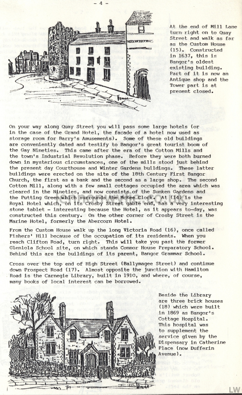
At the end of Mill Lane turn right on to Quay Street
and walk as far as the Custom House (15). Constructed in 1637, this is
Bangor's oldest existing building. Part of it is now an Antique shop and
the Tower part is at present closed. On your way along Quay Street
you will pass some large hotels (or in the case of the Grand Hotel, the
facade of a hotel now used as storage room for Barry's Amusements). Some
of these old buildings are conveniently dated and testify to Bangor's
great tourist boom of the Gay Nineties. This came after the era of the
Cotton Mills and the town's Industrial Revolution phase. Before they
were both burned down in mysterious circumstances, one of the mills
stood just behind the present day Courthouse and Winter Gardens
buildings. These latter buildings were erected on the site of the 18th
Century First Bangor Church, the first as a bank and the second as a
large shop. The second Cotton Mill, along with a few small cottages
occupied the area which was cleared in the Nineties, and now consists of
the Sunken Gardens and the Putting Green which surrounds the McKee
Clock. At (14) is the Royal Hotel which, on its Crosby Street gable end,
has a very interesting stone tablet - interesting because the Hotel, as
it appears to-day, was constructed this century. On the other corner of
Crosby Street in the Marine Hotel, formerly the Abercorn Hotel.
From the Custom House walk up the long Victoria Road
(16), once called Fishers' Hill because of the occupation of its
residents. When you reach Clifton Road, turn right. This will take you
past the former Glenlola School site, on which stands Connor House
Preparatory School. Behind this are the buildings of its parent, Bangor
Grammar School. Cross over the top end of High Street (Ballymagee
Street) and continue down Prospect Road (17). Almost opposite the
junction with Hamilton Road is the Carnegie Library, built in 1910, and
where, of course, many books of local interest can be borrowed.
Beside the Library are three brick houses (18) which were built in 1869
as Bangor's Cottage Hospital. This hospital was to supplement the
service given by the Dispensary in Catherine Place (now Dufferin
Avenue). The bricks for the hospital and indeed for many old
Bangor buildings came from the adjacent Brickfields, which were
converted into the pleasant Ward Park (19) immediately after the Firth
World War. Take the main path through the park, parallel with the little
river. This is the same river as that mentioned earlier as being the
power source for the Corn Mill. Opposite the back exit of Ward Park is
the rear entrance to Castle Park. Notice the Gate Lodge (20), which is
the companion to the house at (1). As you follow the curving path
through the park you might reflect that the whole 148 acres cost Bangor
ratepayers only £34,000 in 1941.
As you approach the castle you will see a small picnic
area at the bottom of the slope. Near this is a tree stump surrounded by
an iron railing (21). It is preserved to commemorate the encampment in
Bangor of the Duke of Schomberg's 1000,000 soldiers in 1689 after
disembarkation. They had arrived to subdue any dissidence in the eastern
part of the country, prior to William III's landing at Carrickfergus the
following year. The Castle (22) as we see it now was built nearly
200 years later, in 1856. R. E. Ward built this handsome Elizabethan
style house on the site of the old Hamilton Castle. It has served Bangor
since 1952 as Town Hall and Council Offices. If access can be gained,
many of Bangor's most precious relics, such as the Bangor Bell, Thomas
Raven's maps of 1625 and some beautiful early photographs, can be seen.
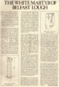
Before leaving the front of the castle, look at the
view over the mouth of Belfast Lough and "round the corner" towards the
Copeland Islands, and consider some of the sights which have been
witnessed from here. Among all the everyday scenes, some incidents must
stand out because of their importance in British, Irish, European or
World History. These might start with the Viking raids on the
Abbey settlement, continue through the time of Con O'Neill's escape from
Ireland after hiding in the Abbey Church Tower; must include more recent
events such as the disembarkation of Schomberg's forces; the capture of
H.M.S. Drake by the American Admiral John Paul Jones in 1778; Thomas
Telford's survey of Bangor Harbour in his unsuccessful attempt to have
the Packet Station transferred here from Donaghadee; the sad sight of
Brunel's iron steamship, the Great Britain limping home from Dundrum in
1847 after going aground there the year before; the gun-running into
Larne, Bangor, and Donaghadee in 1912; the trans-Atlantic liners taking
on passengers from the Tender between the Wars; the German 'planes on
their way to bomb Belfast in 1941; the flights of Concorde above the
Irish Sea in the Seventies; and the Queen's Yacht "Britannia" anchored
off Wilson's Point during her Jubilee Year visit.
a two-hour 'dander' round the Middle of Bangor - Town Trait No. 2
Edited by Harry Allen, Illustrated by Bertha McGimpsey - Seacourt Teachers'
Centre
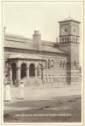
Bangor Historical Town Trail
The Middle of Bangor - A Two Hour 'Dander' Round Some of the Interesting Old
Places in the Town.
When Bangor Town Trail No. 1,
describing a few of the old places to be seen round 'the Back of Bangor'
was written, it was envisaged that Trial No. 2 would cover the better
known parts of the Town, i.e. Main Street, The Sea front and High
Street/ An obvious difficulty was that this area, the commercial heart
of the town, has changed and is changing so much that there are few
visible signs of the streets' history left. However, just at the
right time an alternative approach presented itself. One of Bangor's
most illustrious senior citizens, Alderman Charles F. Milligan, M.B.E.,
passed on to Bangor Historical Society the written recollections of
William Charles Seyers (Sen.) which had been given to Miss Sally Gray.
Charles Seyers was born in 1843 in a little white-washed
cottage at 18 Main Street. He was the son of Henry Seyers, a tenant
farmer, (the four corners of his holding at one time being Nos. 1, 2, 3
and 5 on the map), and a Welsh girl who had come to Ireland as Lady's
Maid to Mrs. R. E. Ward, wife of the owner of Bangor Castle. What
follows are his reminiscences of Bangor in the 1860s, written shortly
before his death in 1941. Occasionally there is a small note of
explanation added - but usually only to bring the information
up-to-date. When checked against any written records such as Street
Directories of Valuation Books it is remarkable how accurate Mr. Seyers'
memory is. His account recalls some of the characters of over a hundred
years ago, and the flavour of life then in Bangor's Main Streets.
He begins :-
I have a good memory
of things that happened in my early boyhood. I remember the first
sod cut for the Belfast, Holywood and Bangor Railway Co. by R. E. Ward,
Esq., of Bangor Castle. It was in the year 1862, and the railway was
three years in the making. Edwards Bros. were the contractors. The first
train came to Bangor on 1st May, 1865. Mr. Ward had a first-class free
ticket or pass while he lived.
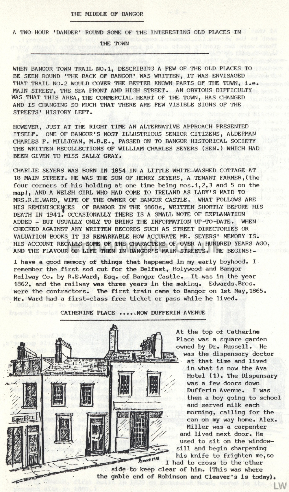
Catherine Place - now Dufferin Avenue
At the top of Catherine Place was a square garden owned
by Dr. Russell. He was the dispensary doctor at that time and lived in
what is now the Ava Hotel (1). The Dispensary was a few doors down
Dufferin Avenue. I was then a boy going to school and served milk each
morning, calling for the can on my way home. Alex. Miller was a
carpenter and lived next door. He used to sit on the window-sill and
begin sharpening his knife to frighten me, so I had to cross to the
other side to keep clear of him. (This was where the gable end of
Robinson and Cleaver's is today). At that time Catherine Place was
the swell street in Bangor. It only went to the stream (2), (covered
over in 1865 by the Railway Company). There were two granite posts and
an iron gate leading into fields which were farmed by Capt. McCullough
of Rathgael. A path led to the sea, between an open stream and fence,
where Southwell Road is at present. A well, from which it takes
its name, was supposed to cure different diseases. James Crosbie had hot
salt water baths at the corner of Sandy Row (now Queen's Parade) and
Southwell Road. (3). He pumped the water from the sea with a small
force pump and charged five shillings for six baths.
Main Street - Left-Hand Side
Main Street had only a few shops in it. The late Mr.
Hanna had the first on the left-hand side going down, then came a few
dwelling-houses. Old John Gray lived in one. He was my first
school-master. He taught in the 'Penny School', where the old market was
held, and had eighty pupils with no assistants. He often had a class of
young men to learn navigation. He was lame, had a short leg, and went on
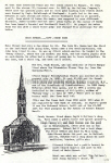
a crutch. The Rev. Hugh Woods, who was minister of First Bangor
lived where the Downshire Flower Shop is, (now the Spinning Mill).
(First Bangor Presbyterian Church was erected on its present site in
1831. It cost £2,600 and its foundation stone was laid by William
Sharman Crawford, M.P., one of the Crawfords of Crawfordsburn. In 1880
Sandy McFerran added the spire, and in 1896 a window was installed to
the memory of W. G. Lyttle, author of "Betsey Gray - a take of '98".)
There were no more houses until the Town Hall (4). (This was the Town
Hall from 1900 until 1933 when it was replaced by the Bank of Ireland.
In Seyer's youth it was the Endowed School, built out of the £1,000 left
for that purpose by the father of Robert Edward Ward).
Sandy Hassan lived where Smyth & McClure's shop is.
Next came a public house and spirit grocer's, (Hugh Furey's), and Hugh
Keenan ran the post car to Newtownards, often with one or two
passengers. Robert Neill had a boot shop. The Post Office was kept by
Miss Long. John Moore drove the post car to Belfast, and Dr.
Ritchie had a shop where he sold medicine, leeches, pills etc. Stewart
Aicken had a public house; he left Church Quarter and went to the foot
of Main Street. Next was what was called 'The Cellars', and Jenny
Garrety's abode. (5)
Main Street - Right-Hand Side
The Demesne wall projected out half-way across the
street, the door (6) facing down Main Street. Next was a gateway into
Henry McDowell's farm-yard. Capt. Pollock and H. McDowell were next -
two small houses where the Post Office is. Then came Hugh Campbell,
carpenter, now the 'Spectator' buildings. (7) Where the Parish
Church grounds are was the Temperance Hotel (8). Meetings were held in
it and it had a pulpit. An infant school was also held in it; Miss
Monroe was the teacher. Farther on were a few small houses; Tanners and
Ritchie lived in them. An open field was next where I planted potatoes
and turnips for Robert Bowman. May Avenue was a Rugby football ground.
At the top of the street there was a lane that went to the brick field.
Bricks were made there and taken to Cultra and Craigavad to build the
station houses. (The brick field is now Ward Park). I remember
when there was no Hamilton Road, just two houses at the upper end of the
Ward School. In one Robert Bowman had a butcher's shop; next was Capt.
McFerran, then the Market House (now Ward School), with iron gates where
windows are, beams and scales. (The school known for years as the
Ward School was actually the Church Education Society's School. Opposite
it was the school endowed by Robert Ward in 1856. The beams and scales
mentioned were part of the weighbridge attached to the old Markey
House). (9).
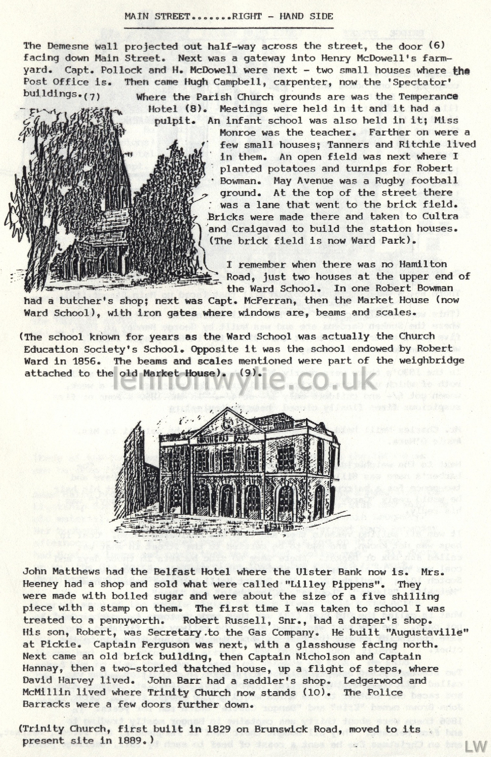
John Matthews had the Belfast Hotel where the Ulster
Bank now is. Mrs. Heeney had a shop and sold what were called "Lilley
Pippens". They were made with boiled sugar and were about the size
of a five shilling piece with a stamp on them. The first time I was
taken to school I was treated to a pennyworth. Robert Russell, Snr., had
a draper's shop. His son, Robert, was Secretary to the Gas Company. He
built "Augustaville" at Pickie. Captain Ferguson was next, with a
glasshouse facing north. Next came an old brick building, then Captain
Nicholson and Captain Hannay, then a two-storied thatched house, up a
flight of steps, where David Harvey lived. John Barr had a saddler's
shop. Ledgerwood and McMillin lived where Trinity Church now stands
(10). The Police Barracks were a few doors further down. (Trinity
Church, first built in 1829 on Brunswick Road, moved to its present sire
in 1889.)
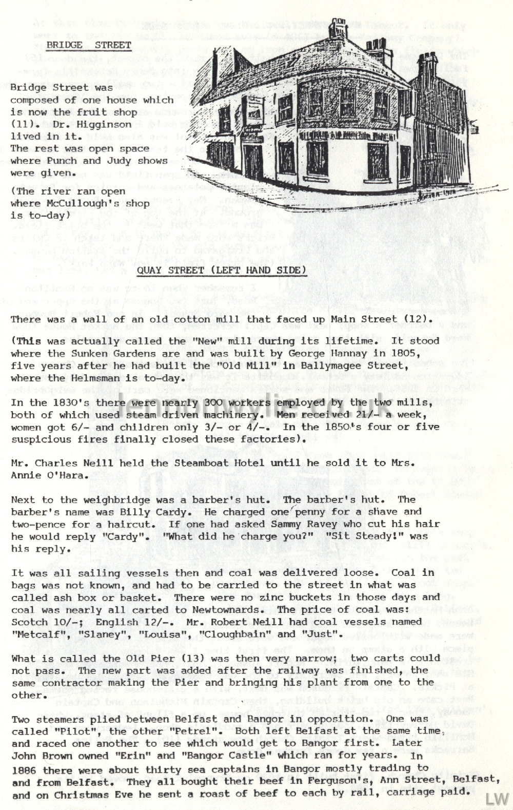
Bridge Street
Bridge Street was composed of one house which is now
the fruit shop (11). Dr. Higginson lived in it. The rest was open space
where Punch and Judy shows were given. (The river ran open where
McCullough's shop is to-day)
Quay Street (left-hand side)
There was a wall of an old cotton mill that faced up
Main Street (12). (This was actually called the "New" mill during its
lifetime. It stood where the Sunken Gardens are and was built by George
Hannay in 1805, five years after he had built the "Old Mill" in
Ballymagee Street, where the Helmsman is to-day. In the 1830's
there were nearly 300 workers employed by the two mills, both of which
used steam driven machinery. Men received 21/- a week, women for 6/- and
children only 3/- or 4/-. In the 1850's four or five suspicious
fires finally closed these factories). Mr. Charles Neill held the
Steamboat Hotel until he sold it to Mrs. Annie O'Hara. Next to the
weighbridge was a barber's hut. The barber's hut. The barber's name was
Billy Cardy. He charged one penny for a shave and tw0-pence for a
hair-cut. If one had asked Sammy Ravey who cut his hair he would reply
"Cardy". "What did he charge you?" "Sit Steady!" was his reply.
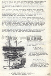
It was all sailing vessels then and coal was delivered
loose. Coal in bags was not known, and had to be carried to the street
in what was called ash box or basket. There were no zinc buckets in
those days and coal was nearly all carted to Newtownards. The price of
coal was: Scotch 10/-; English 12/-. Mr. Robert Neill had coal vessels
named "Metcalf", "Slaney", "Louisa", "Cloughbain" and "Just". What
is called the Old Pier (13) was then very narrow; two carts could not
pass. The new part was added after the railway was finished, the same
contractor making the Pier and bringing his plant from one to the other.
Two steamers plied between Belfast and Bangor in opposition. One was
called "Pilot", the other "Petrel". Both left Belfast at the same time,
and raced one another to see which would get to Bangor first. Later John
Brown owned "Erin" and "Bangor Castle" which ran for years. In 1886
there were about thirty sea captains in Bangor mostly trading to and
from Belfast. They all bought their beef in Ferguson's, Ann Street,
Belfast, and on Christmas Eve he sent a roast of beef to each by rail,
carriage paid.
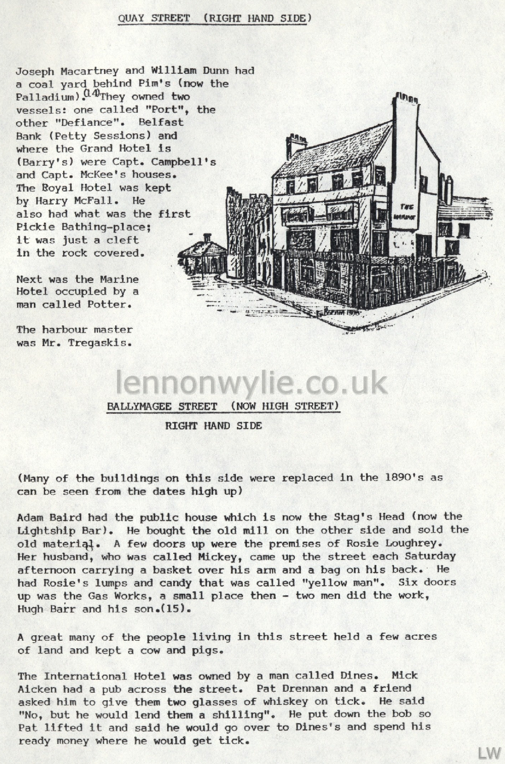
Quay Street (right-hand side)
Joseph Macartney and William Dunn had a coal yard
behind Pim's (now the Palladium). (14) They owned two vessels: one
called "Port", the other "Defiance". Belfast Bank (Petty Sessions) and
where the Grand Hotel is (Barry's) were Capt. Campbell's and Capt.
McKee's houses. The Royal Hotel was kept by Harry McFall. He also had
what was the first Pickie Bathing-place; it was just a cleft in the rock
covered. Next was the Marine Hotel occupied by a man called
Potter. The harbour master was Mr. Tregaskis.
Ballymagee Street (now High Street)
(Many of the buildings on this side were replaced in
the 1890's as can be seen from the dates high up) Adam Baird had
the public house which is now the Stag's Head (now the Lightship Bar).
He bought the old mill on the other side and sold the old material. A
few doors up were the premises of Rosie Loughrey. Her husband, who was
called Mickey, came up the street each Saturday afternoon carrying a
basket over his arm and a bag on his back. He had Rosie's lumps and
candy that was called "yellow man". Six doors up was the Gas Works, a
small place then - two men did the work, Hugh Barr and his son. (15)
A great many of the people living in this street held a few acres of
land and kept a cow and pigs. The International Hotel was owned by
a man called Dines. Mick Aicken had a pub across the street. Pat Drennan
and a friend asked him to give them two glasses of whiskey on tick. He
said "No, but he would lend them a shilling". He put down the bob so Pat
lifted it and said he would go over to Dines's and spend his ready money
where he would get tick.
Ballymagee Street (left-hand side)
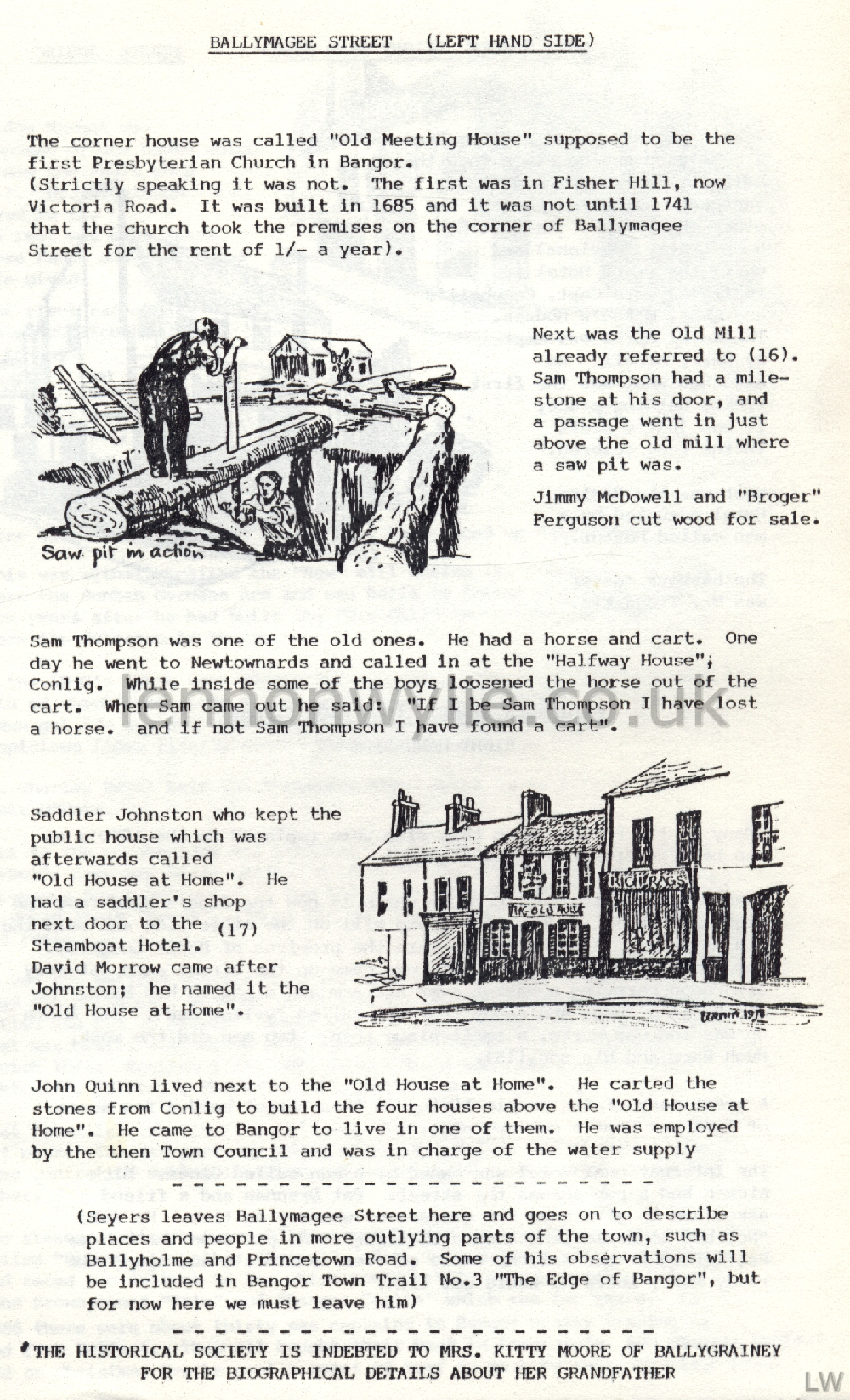
The corner house was called "Old Meeting House"
supposed to be the first Presbyterian Church in Bangor. (Strictly
speaking it was not. The first was in Fisher Hill, now Victoria Road. It
was built in 1685 and it was not until 1741 that the church took the
premises on the corner of Ballymagee Street for the rent of 1/- a year).
Next was the Old Mill already referred to (16). Sam Thompson had a
mile-stone at his door, and a passage went in just above the old mill
where a saw pit was. Jimmy McDowell and "Broger" Ferguson cut wood
for sale. Sam Thompson was one of the old ones. He had a horse and
cart. One day he went to Newtownards and called in at the "Halfway
House", Conlig. While inside some of the boys loosened the horse out of
the cart. When Sam came out he said: "If I be Sam Thompson I have lost a
horse, and if not Sam Thompson I have found a cart". Saddler
Johnston who kept the public house which was afterwards called "Old
House at Home". He had a saddler's shop next door to the Steamboat
Hotel. (17) David Morrow came after Johnston; he named it the "Old
House at Home". John Quinn lived next to the "Old House at Home".
He carted the stones from Conlig to build the four houses above the "Old
House at Home". He came to Bangor to live in one of them. He was
employed by the then Town Council and was in charge of the water supply.
(Seyers leaves Ballymagee Street
here and goes on to describe places and people in more outlying parts of the
town, such as Ballyholme and Princetown Road. Some of his observations will
be included in Bangor Town Trail No. 3 (I don't have it yet!)
"The Edge of Bangor", but for now here we must leave him)
The Historical Society is indebted to Mrs. Kitty Moore of Ballygrainey for
the biographical details about her grandfather.
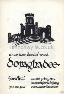 
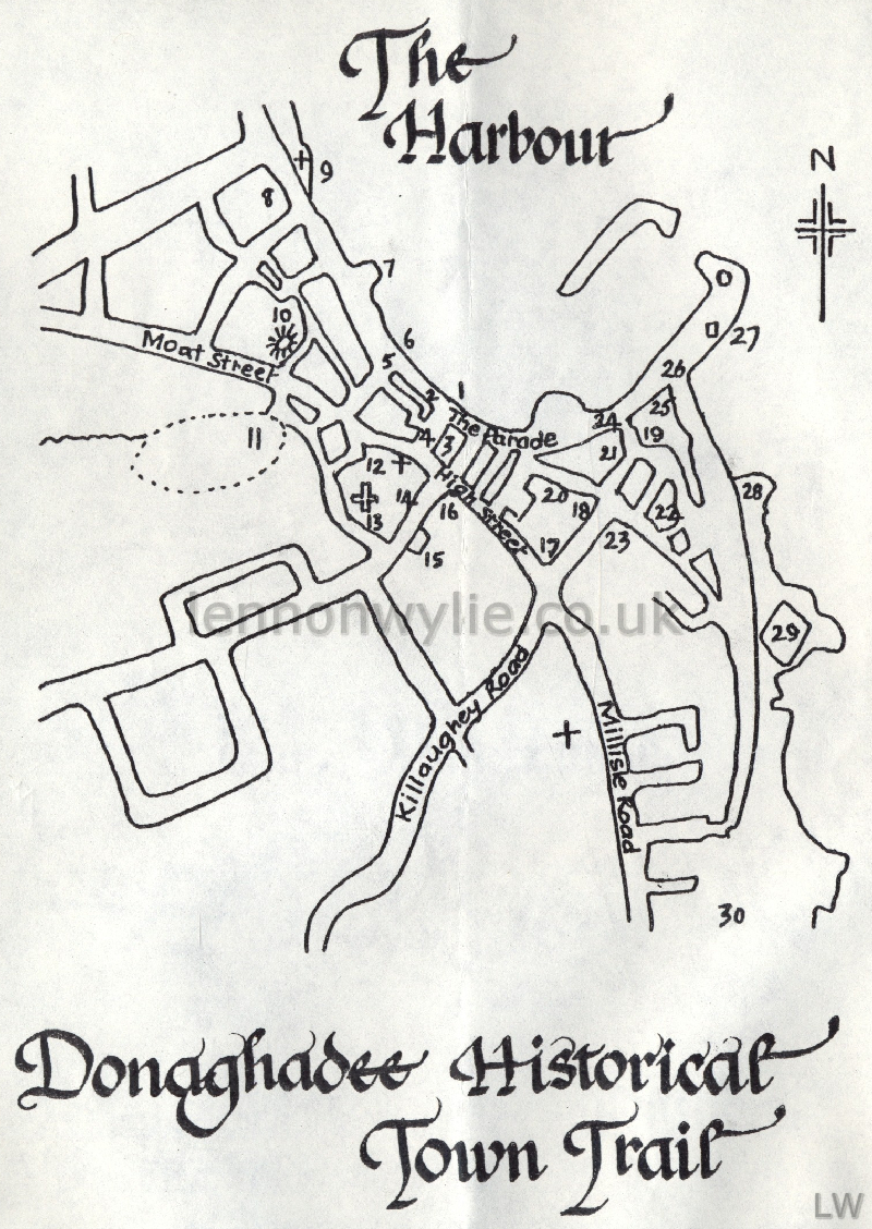
a two-hour 'dander' round Donaghadee - Town Trail Compiled by Harry Allen,
Illustrated by Bertha McGimpsey
Seacourt Teachers' Centre
Donaghadee Historical Town Trail
A Two Hour 'Dander' Round Some of the Interesting Places in the Town
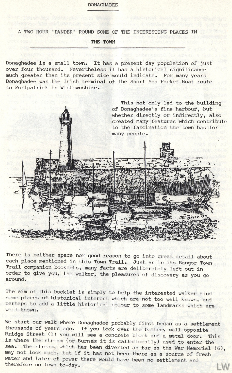
Donaghadee is a small town. It has a present day population of
just over four thousand. Nevertheless it has a historical significance
much greater than its present size would indicate. For many years
Donaghadee was the Irish terminal of the Short Sea Packet Boat route to
Portpatrick in Wigtownshire. This not only led to the building of
Donaghadee's fine harbour, but whether directly or indirectly, also
created many features which contribute to the fascination the town has
for many people. There is neither space nor good reason to go into great
detail about each place mentioned in this Town Trail. Just as in its
Bangor Town Trail companion booklets, many facts are deliberately left
out in order to give you, the walker, the pleasures of discovery as you
go around. The aim of this booklet is simply to help the interested
walker find some places of historical interest which are not too well
known, and perhaps to add a little historical colour to some landmarks
which are well known.
We start our walk where Donaghadee probably first began
as a settlement thousands of years ago. If you look over the battery
wall opposite Bridge Street (1) you will see a concrete block and a
metal door. This is where the stream (or Burnas it is called locally)
used to enter the sea. The stream, which has been diverted as far as the
War Memorial (6), may not look much, but if it has (had) not been there
as a source of fresh water and later of power there would have been no
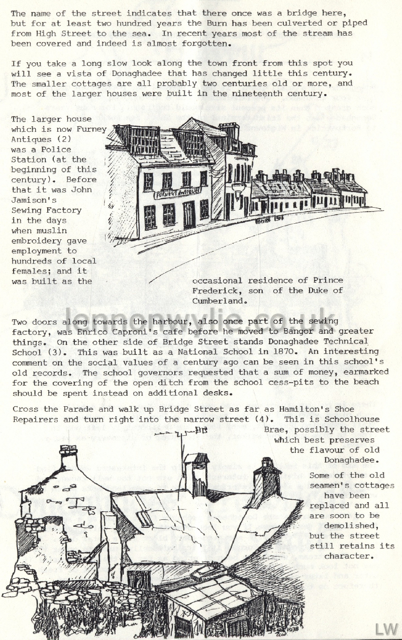
settlement and therefore no town to-day. The name of the street
indicates that there once was a bridge here, but for at least two
hundred years the Burn has been culverted or piped from High Street to
the sea. In recent years most of the stream has been covered and indeed
is almost forgotten. If you take a long slow look along the town front
from this spot you will see a vista of Donaghadee that has changed
little this century. The smaller cottages are all probably two centuries
old or more, and most of the larger houses were built in the nineteenth
century.
The larger house which is now Furney Antiques (2) was a
Police Station (at the beginning of this century). Before that it was
John Jamison's Sewing Factory in the days when muslin embroidery gave
employment to hundreds of local females; and it was built as the
occasional residence of Prince Frederick, son of the Duke of Cumberland.
Two doors along towards the harbour, also once part of the sewing
factory, was Enrico Caproni's cafe before he moved to Bangor and greater
things. On the other side of Bridge Street stands Donaghadee Technical
School (3). This was built as a National School in 1870. An interesting
comment on the social values of a century ago can be seen in this
school's old records. The school governors requested that a sum of
money, earmarked for the covering of the open ditch from the school
cess-pits to the beach should be spent instead on additional desks.
Cross the Parade and walk up Bridge Street as far as Hamilton's Shoe
Repairers and turn right into the narrow street (4). This is Schoolhouse
Brae, possibly the street which best preserves the flavour of old
Donaghadee.
Some of the old seamen's cottages have been replaced
and all are soon to be demolished, but the street still retains its
character. When you reach house No. 7 (a beautiful example of a well
preserved old cottage) stop and have a good look around. Almost
everything of significance in Donaghadee's history can be seen from just
here - the harbour, the lighthouse, the old Railway Station, the row of
fishermen's cottages just below, the Moat to the left, the Copeland
Islands in front, and, on a clear day, Scotland on the horizon. Go
along to the end of the Schoolhouse Brae. The two storey part of the
house on the right (5) is all that is left of the eighteenth century
school which gave its name to the Brae. The house on the left was built
in the 1920s to replace an older house which just decoded to collapse to
rubble one day, fortunately while the owner was out.
Turn right into Union Street and immediately left to
walk along Shore Street, or Sandy Row as the Donaghadee folk called it
years ago. On the left is a terrace of 1890s houses built for
professional people. Across the road are the castellated ruins of the
Baths Hotel (7) beside the War Memorial (6). From here as far as Shore
Street Presbyterian Church was Francis Saul's Rope Walk. Here for many
years he, or one of his workers, would twist hemp or jute into ropes by
walking backwards from a post to which the twines were tied. Just
past East Street is a short terrace of old red brick houses (8). These
one-time residences and headquarters of the Coastguards were built at a
time when smuggling was rife. The site was chosen to give a wider view
of the sea than that possible from their older station (now Johnson's
Furniture shop (24). There was an intention to raze all the buildings on
the shore side of the street, but this was never done. The dates on the
Church (9) and the 1891 National School opposite show that they were
there before the Coastguard dwellings were erected a hundred years ago.
On the shore here were loaded thousands of head of live
cattle for shipment to Scotland and England in the eighteenth century.
To reach the shore the cattle which came from all over the northern part
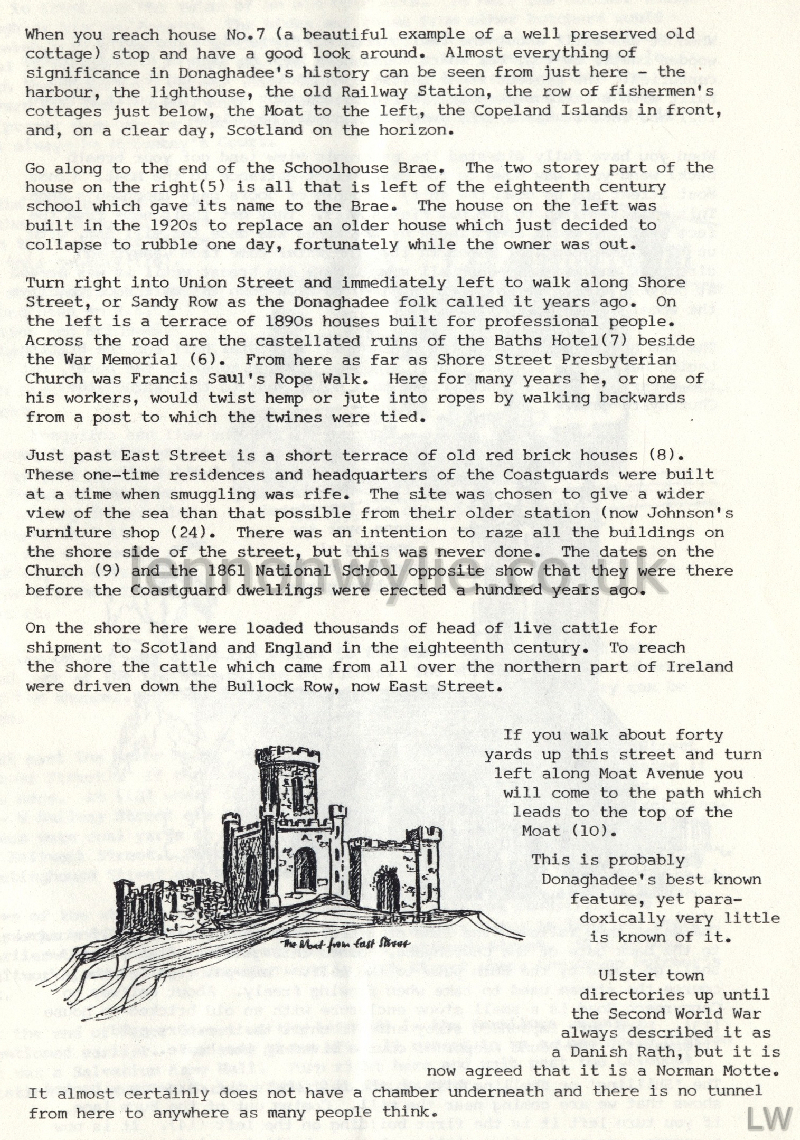
of Ireland were driven down the Bullock Row, now east Street. If
you walk about forty yards up this street and turn left along Moat
Avenue you will come to the path which leads to the top of the Moat
(10). This is probably Donaghadee's best known feature, yet
paradoxically very little is known of it. Ulster town directories up
until the Second World War always described it as a Danish Rath, but it
is now agreed that it is a Norman Motte. It almost certainly does not
have a chamber underneath and there is no tunnel from here to anywhere
as many people think. When it was built about the twelfth century
there might have been a wooden castle on top, but there would have been
no sign of this in recent centuries. The present stone castle is a
"folly", but unlike most was built with a serious purpose. While the
harbour was being built between 1821 and 1834 it was a safe and secure
powder magazine.
When you have fully digested the panoramic view (and
got your breath back) wend your way down to the Moat Street entrance to
the Moat. Cross Moat Street and go down the entry a couple of doors past
Thompson's shop. This will take you to the Dam Fields (11). They get
their name from the fact that the whole area ringed by the trees was
once the mill dam, with up to 10 feet depth of water in it. The water
came from Cannyreagh direction and was held back all summer by a dam
breast until it was needed at harvest time. It was then released to flow
down the mill race to drive the wheel at the Corn Mill. The dam
breast was between the present day Parochial Hall and the British Legion
Hall. The present uphill slope would seem to argue the point, but the
water ran across Church Place to a point just to the left of the
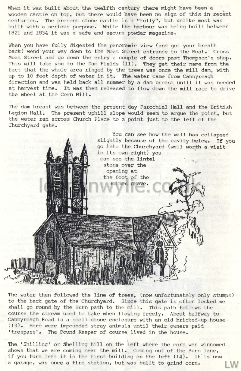
Churchyard gate. You can see how the wall has collapsed slightly because
of the cavity below. If you go into the Churchyard (well worth a visit
in its own right) you can see the lintel stone over the opening at the
foot of Holmes grave. The water then followed the line of trees, (now
unfortunately only stumps) to the back gate of the Churchyard. Since
this gate is often locked we shall go round by the Burn path to the
mill.
This path follows the course the stream used to take
when flowing freely. About halfway to Cannyreagh Road is a small stone
enclosure with an old bricked-up house (13). Here were impounded stray
animals until their owners paid 'trespass'. The Pound Keeper of course
lived in the house. The 'Shilling' or Shelling hill on the left
where the corn was winnowed shows that we are coming near the mill.
Coming out of the Burn lane, if you turn left it is the first building
on the left (14). It is now a garage, was once a fire station, but was
built to grind corn. Just in front are the ruins of an old
butcher's. In here the butcher would slaughter his own beasts. The hides
and those from other butchers would be taken across the road to the
little square, which has old ruined houses round it to-day (15). Here
was the tanyard. In the ground were pits in which the hides were cured.
Near the end of the last century when the tanyard had long closed,
Robert McConkey built seven houses for renting. Its proper name may be
Church Square, but for many old Donaghadee folk it will always by
McConkey's Court.
At the foot of Church Lane is the building which has
been the town Post Office all this century (16). For many years
previously it had been an R.I.C. station and Bridewell or Lock-up. Turn
right into High Street. This street, which has pretty well always been
the heart of the town, has so many interesting features that it deserves
a separate booklet, so this little guide will not linger over it.
However on your way along the street to the Manor House you might take a
good look at the features of the buildings. The shop windows are
interesting for the shopper, but it is above the shop fronts where the
history can be seen. Just past the Manor House (17) turn left down
Donaghadee's old Back Street (Manor Street). If there was ever such a
place as industrial Donaghadee it was here. Ay (18) where the Tivoli Bar
is now, and at (19) where Nos. 2 - 8 Railway Street are now, were
Connolly's and Evan's lemonade factories. There were coal yards at (20)
in Bow Street, (21) in Manor Street, and (22) in Saltwork Street. There
were Smiths' forges at (23) on the corner of Meetinghouse Street and one
beside (20) in Bow Street.
Some of the streets here got their names from adjacent
industry. The Gasworks and the railway both gave birth to street names
in 1860 and years earlier there were Salt Pans at the end of Saltwork
Street. (The actual saltworks, confusingly enough, were in High Street
where the Co-op butcher's is. At the end of Manor Street on the left
(24) is the furniture showroom mentioned earlier. For many years after
it ceased to be a Coastguard Station it was a Salvation Army Hall. Turn
right here and walk past the Lifeboat Station (25) and the Harbour
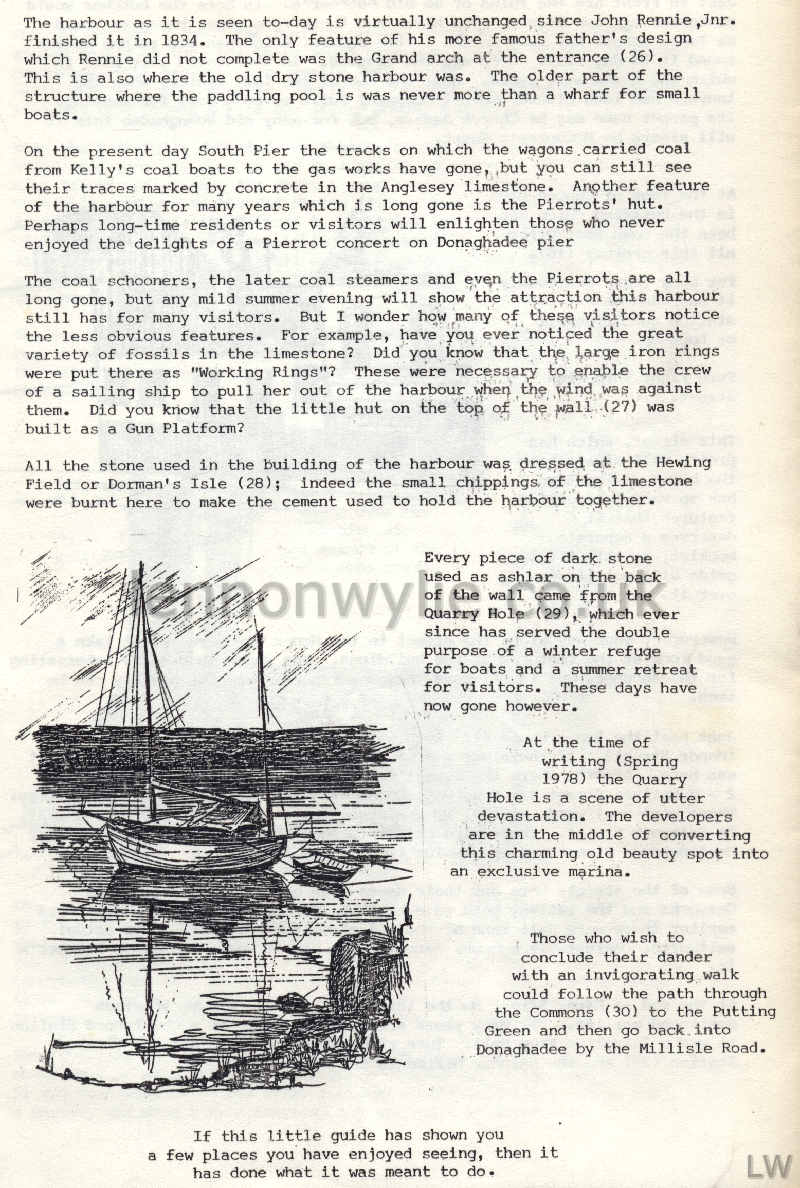
Office to the harbour. The harbour as it is seen to-day is
virtually unchanged since John Rennie, Jnr. finished it in 1834. The
only feature of his more famous father's design which Rennie did not
complete was the Grand arch at the entrance (26). This is also where the
old dry stone harbour was. The older part of the structure where the
paddling pool is was never more than a wharf for small boats. On the
present day South Pier the tracks on which the wagons carried coal from
Kelly's coal boats to the gas works have gone, but you can still see
their traces marked by concrete in the Anglesey limestone.
Another feature of the harbour for many years which is
long gone is the Pierrots' hut. Perhaps long-time residents or visitors
will enlighten those who never enjoyed the delights of a Pierrot concert
on Donaghadee pier. The coal schooners, the later coal steamers
and even the Pierrots are all long gone, but any mild summer evening
will show the attraction this harbour still has for many visitors. But I
wonder how many of these visitors notice the less obvious features. For
example, have you ever noticed the great variety of fossils in the
limestone? Did you know that the large iron rings were put there as
"Working Rings"? These were necessary to enable the crew of a sailing
ship to pull her out of the harbour when the wind was against them. Did
you know that the little hut on the top of the wall (27) was built as a
Gun Platform? All the stone used in the building of the harbour was
dressed at the Hewing Field or Dorman's Isle (28); indeed the small
chippings of the limestone were burnt here to make the cement used to
hold the harbour together. Every piece of dark stone used as ashlar on
the back of the wall came from the Quarry Hole (29), which ever since
has served the double purpose of a winter refuge for boats and a summer
retreat for visitors. These days have now gone however.
At the time of writing (Spring 1978) the Quarry Hole is
a scene of utter devastation. The developers are in the middle of
converting this charming old beauty spot into9 an exclusive marina.
Those who wish to conclude their dander with an invigorating walk could
follow the path through the Commons (30) to the Putting Green and then
go back into Donaghadee by the Millisle Road.
If this little guide has shown you a few places you
have enjoyed seeing, then it has done what it was meant to do.


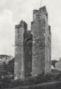


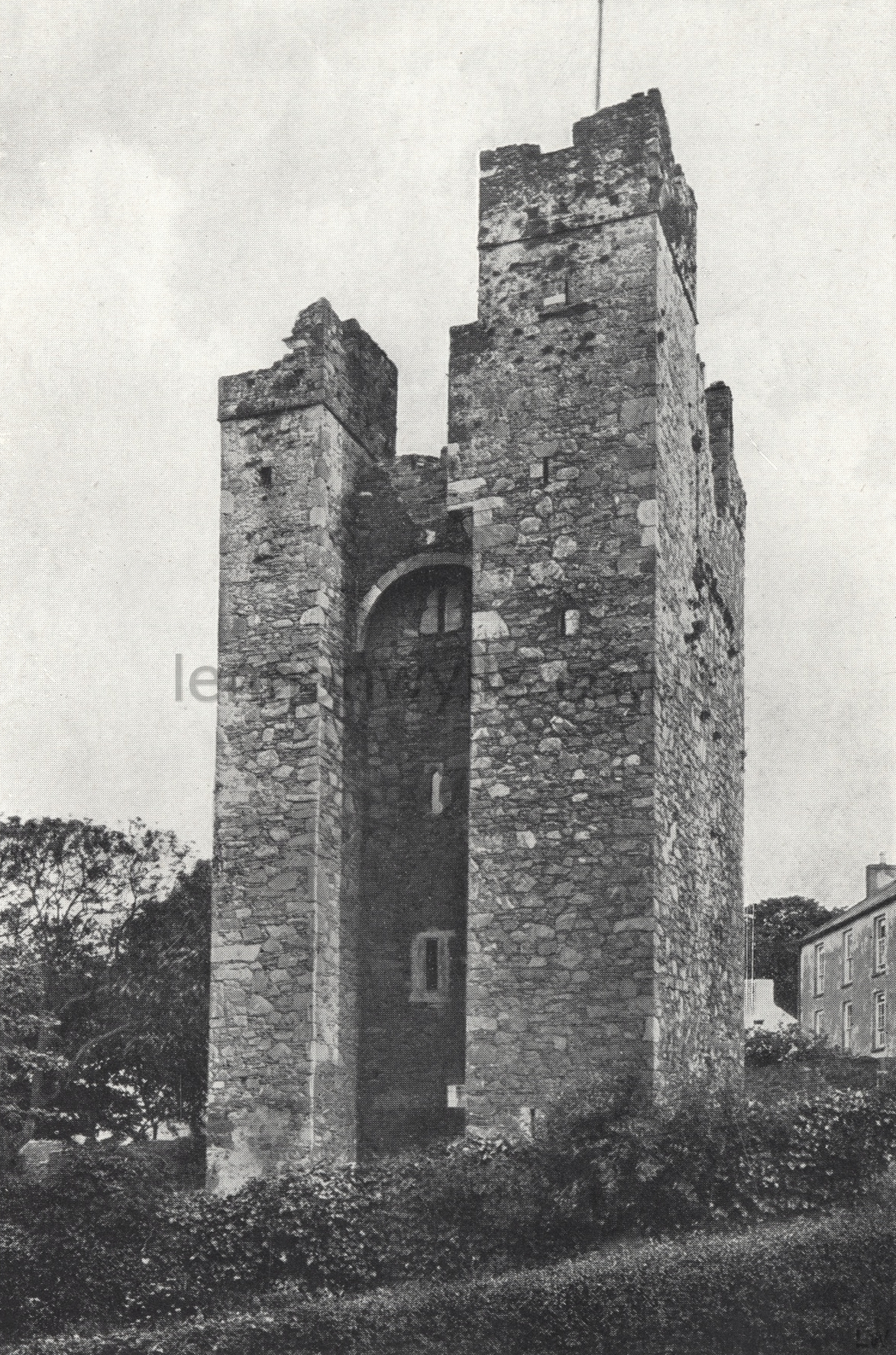
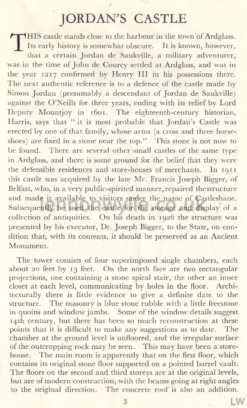
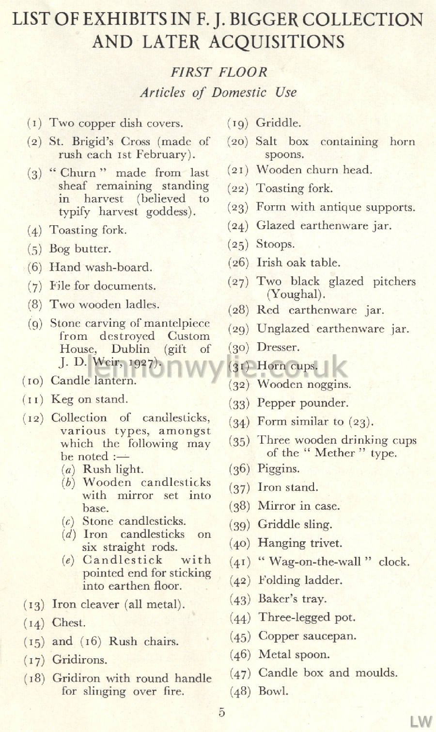
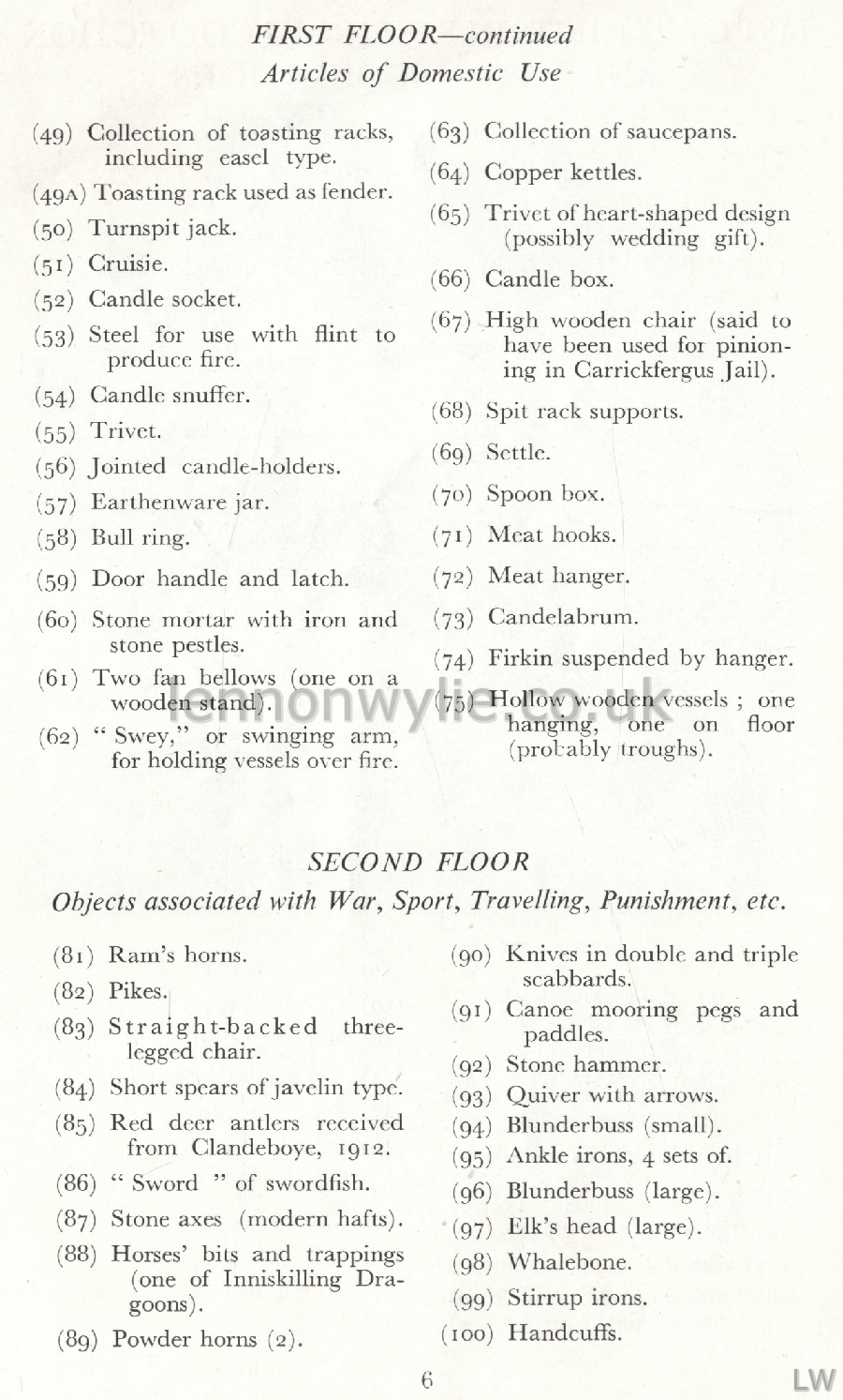
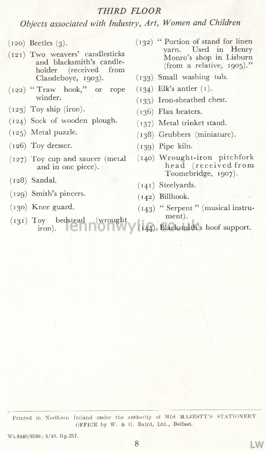
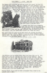
A Guide to Jordan's Castle and F. J. Bigger Collection of Antiquities.
Ardglass, Co. Down 1949
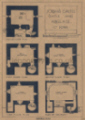
Photo 1: View from North, A. R. Hogg
Photo 2: View from South-West, R. J. Welch
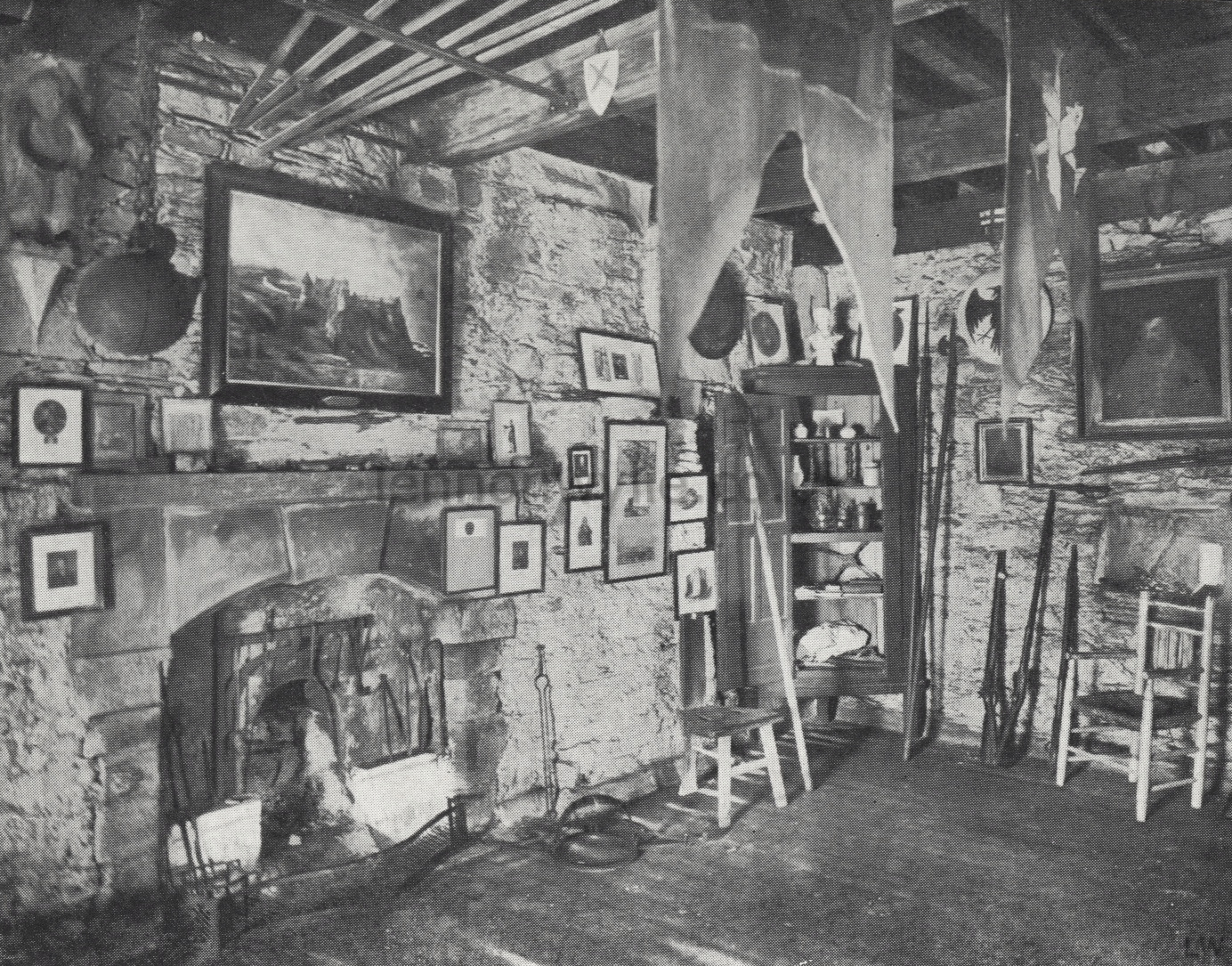
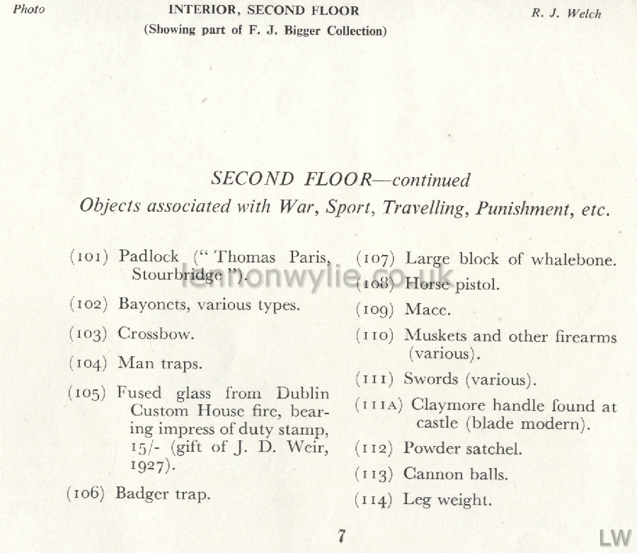
Photo 3: Interior, Second Floor, R. J. Welch
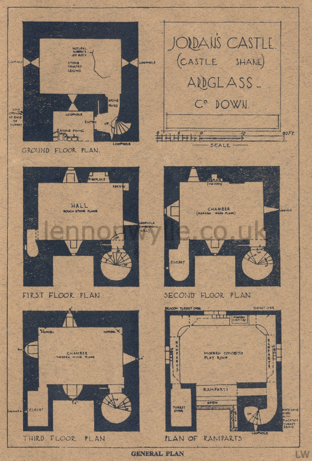
Image 4 (brown): Floor Plan


The Bangors and Ballyculter, An Historical Sketch of the Parish of
Ballyculter (Strangford) by The Rev. W. E. Kennedy, M.A., R.D.
Rector of Ballyculter and Kilclief Parishes. With a Foreword by Edward Ward,
VIIth Viscount Bangor
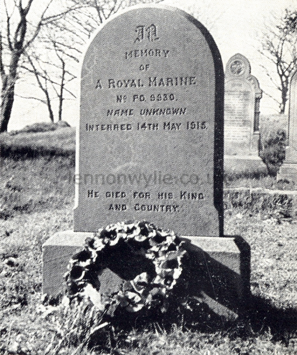
Ballyculter's Unknown Warrior: In the south part of the graveyard there is a
headstone with the inscription "In memory of a Royal Marine, No. PO 9930.
Name Unknown, Interred 14th May 1915." - The mystery began in May 1915 when
the badly decomposed body of a man was washed ashore near Strangford in the
Parish of Ballyculter. There was no identity disc, but the tattered clothing
was that of a Royal Marine. On the clothing was stamped a number, PO 9930.
The body being buried with full military honours. Who was this man? If his
number was known how was he not identified? To help solve the mystery
the matter was raised with the Imperial War Graves Commission who, in turn,
contacted the Admiralty. The Admiralty stated that it had not been possible
to identify the Royal Marine, even with the assistance of the official
number. It all seemed so strange!
A few years ago after a
lapse of about 30 years, a renewed attempt was made to solve the mystery. If
his number was known, wouldn't this appear in official records? This time
the matter was referred to the Royal Marines' Historian at Southsea, Hants.
He looked up the records and found that two men had had this number, but one
without the prefix PO. The number PO 9930 belonged to a man called Edward
George Francis Camm, a Marine who enlisted in London in 1899 and who was
"discharged dead" on HMS Roxburgh in 1910. So he was not the man. The number
9930, without the PO, belonged to a man named John Brian, a Royal Navy
Rating from Cork who enlisted in 1854, aged 22. He was drafted to HMS
Crocodile, but there was no trace of him having joined the ship and no
record of service. In 1915 he would have been over 80, so clearly he was not
the man either. What was the explanation? The Royal Marine
historian gives his view: "A possible explanation of the number is
that in the very rapid expansion of the Marine Corps in 1914-15 a great
quantity of used clothing and equipment had to be issued to Reservists and
new entries. The unknown Marine might easily have been issued with articles
which had been returned to the store when the previous owner had been
"discharged dead" in 1910 and which still bore the original owner's number."
He adds, sadly: "Sea losses in 1914-15 were so heavy that any attempt to
identify this body is hopeless." This seems the most likely
explanation when we remember that the number was not on an identity disc,
but on clothing, but it prompts a further question. Normally only
large warships carried Royal Marines. What large warship was sunk from which
the body might have come and which would have had a crew list? The
answer to this is that to combat the heavy toll of the U-boats, merchant
ships were armed and Royal Marines were seconded to these ships to man the
guns. It is most likely that the unknown Royal Marine was aboard an armed
merchant ship torpedoed in the North Sea. So, the mystery of his identity
will never now be solved. In one way it is a good thing, for to the
people of Ballyculter he has become their own "Unknown Warrior" and on every
Armistice Day and Remembrance Sunday since 1915 a wreath has been laid by
them on his grave. He represents all those who gave their lives in the
service of their country, but especially those whose names are known only to
God.
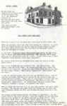
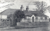
Ballyculter National School 1823 - This school was built in 1823 at the
expense of Lord Bangor at a cost of £200. He also endowed it. It replaced an
earlier school building. It was a fine building. From its
beginning it was a mixed school where Roman Catholic and Protestant children
met each other from an early age. Local people are convinced that this mixed
school played an important part in preventing sectarianism in the district,
and in fostering the good community relations which exist today. Under
a new educational policy of centralisation it was closed in 1969, in spite
of strong opposition from many quarters. The Roll Books and other
school records from 1877-1969 are now in the custody of the Public Records
Office, Belfast, where they may be consulted. The school building was
purchased by Ballyculter Parish in 1974 and leased to the present occupant
as a dwelling house. The old tablet has been preserved on the wall, stating
simply, 'National School, 1823'. The word "Ballyculter" was erased during
the last War so that, if the Germans landed, they wouldn't know where they
were!

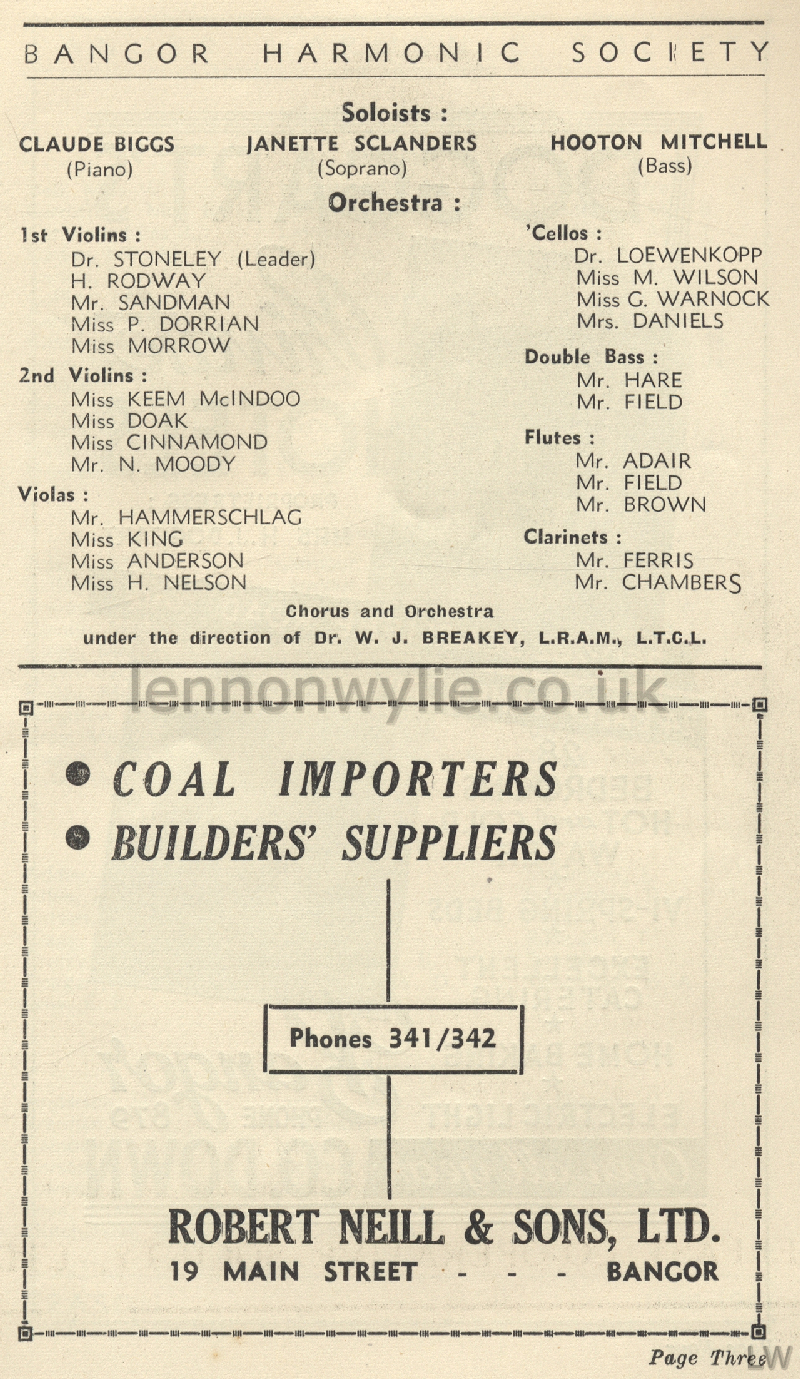
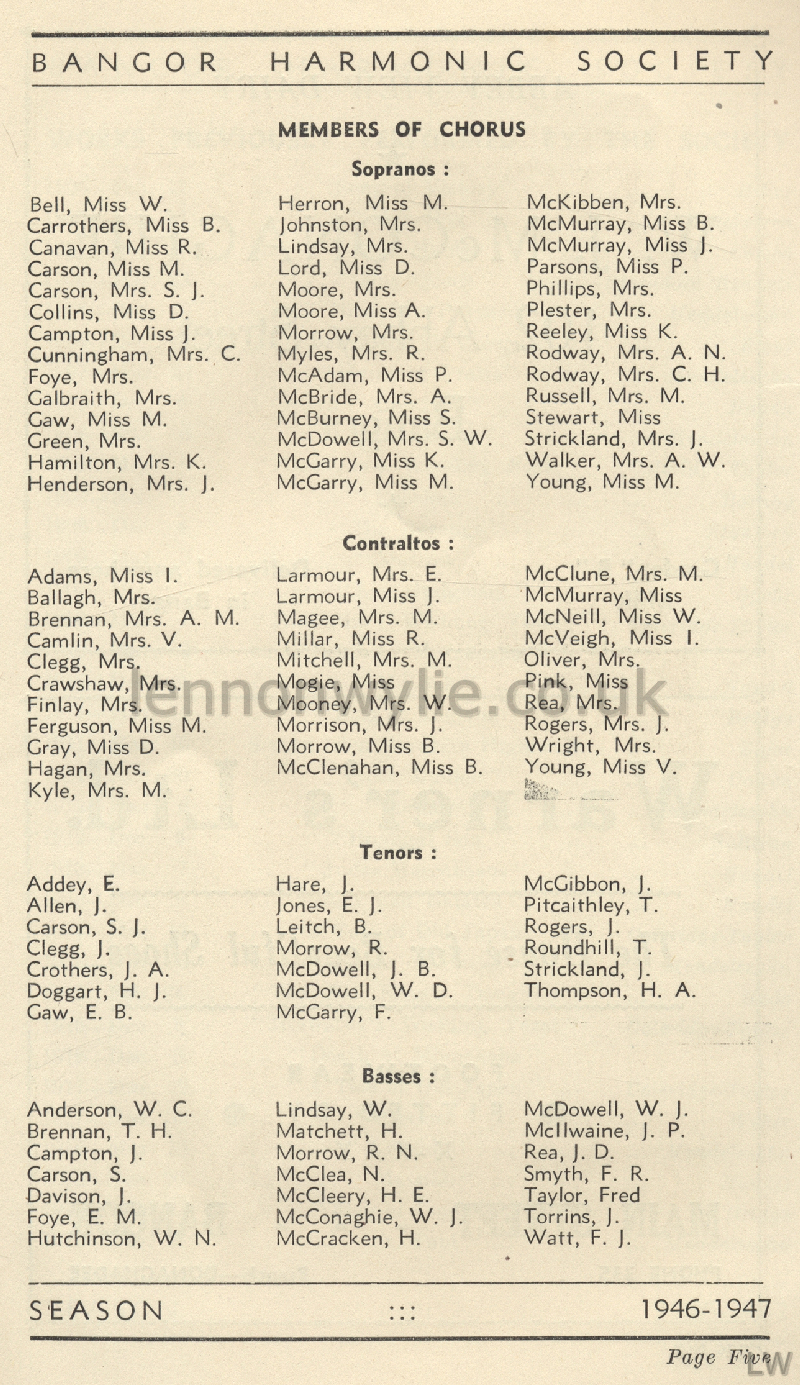
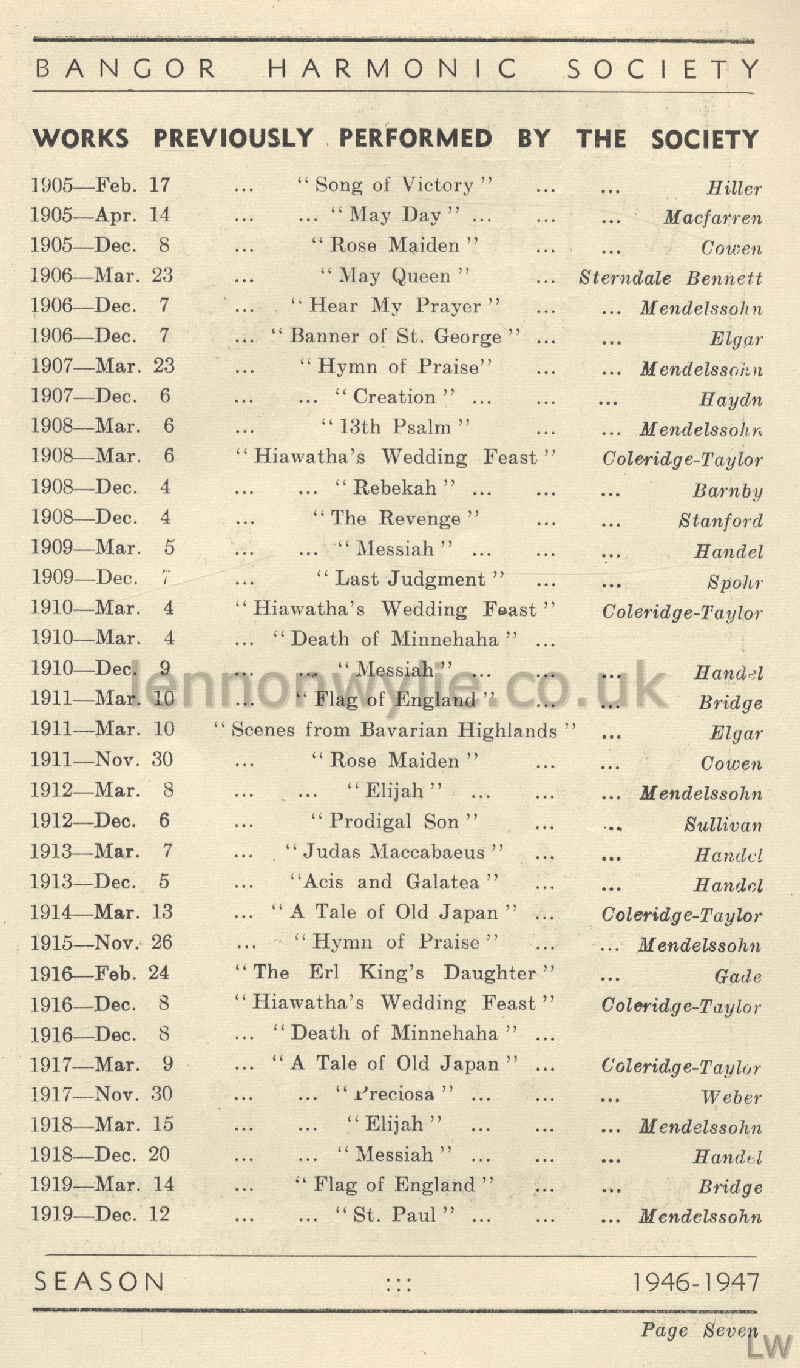
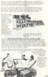
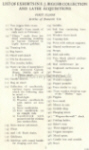
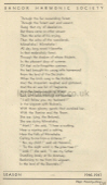
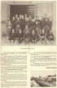
Bangor Harmonic Society Season 1946-47


1
2
3
4
5
6
7
8
9
I won't list all the names, there are so many
1) Office-Bearers; Patrons; President; Vice-Presidents; Committee; Hon.
Secretary; Assistant Hon. Secretary; Hon. Treasurer; Subscribing Members
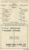
2) Soloists; Orchestra (Robert Neill & Sons, Ltd., advert)
3) Members of Chorus
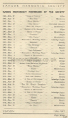
4) Works Previously Performed by the Society
5) Works continued (Pollock Jewellers advert)
6) Works continued (H. Lindsay & Co., Outfitters advert)
7) Personal Foreword (S. B. Gaw, F.A.I. advert)
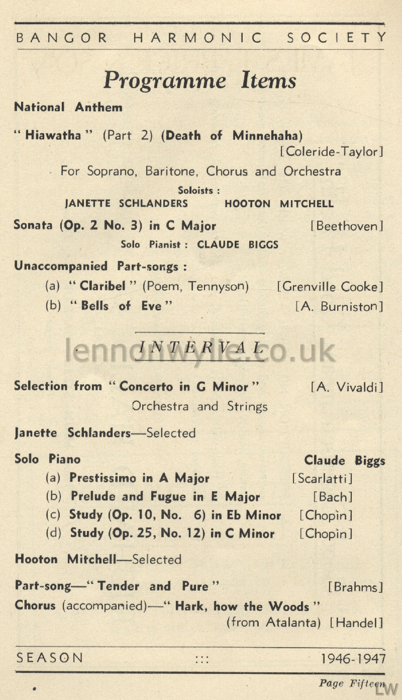
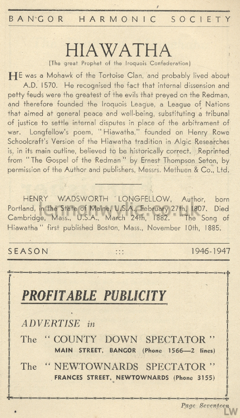
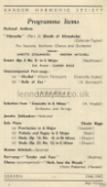
8) Programme Items (Hiawatha)
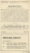
9) Hiawatha (Spectator advert)


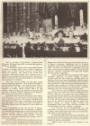
1
2
3
4
5
6
7
8
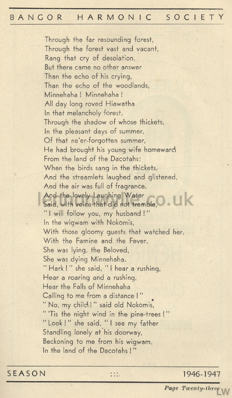
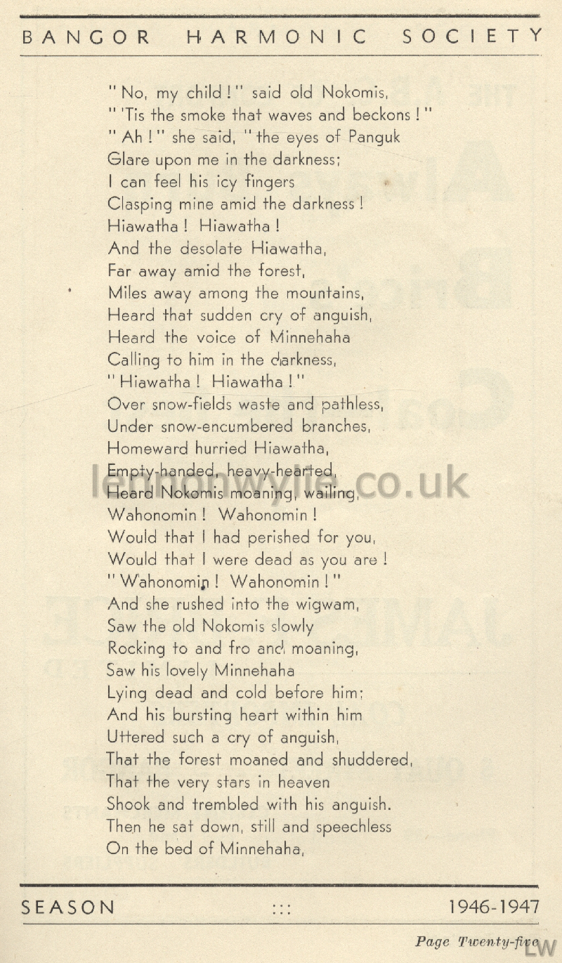
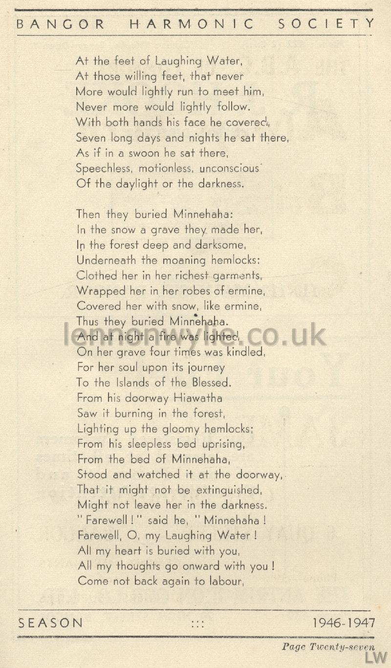
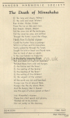
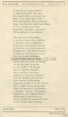
1) The Death of Minnihaha ....
2) continued ....
3) continued ....
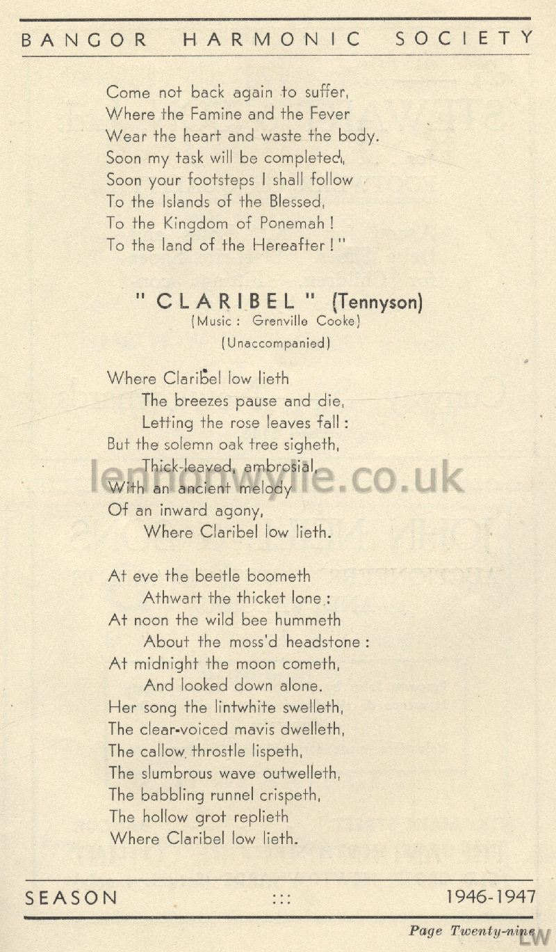
4) continued ....
5) continued ....
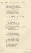
6) continued .... Claribel (Tennyson)
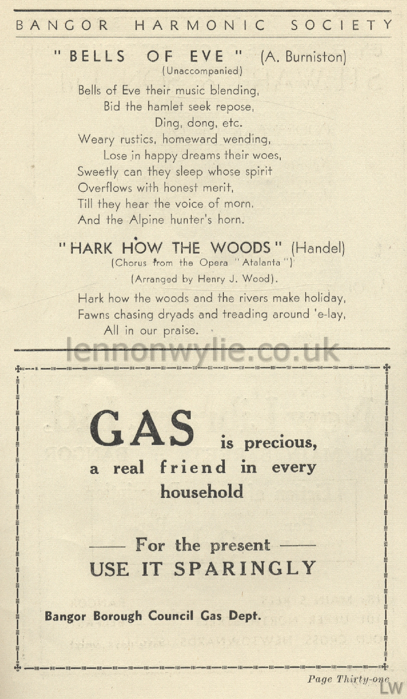
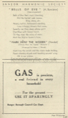
7) Bells of Eve - Hark How the Woods (Bangor Borough Council Gas Dept.
advert)
8) Tender and Pure, O Love, Art Thou (Brahms) (New Library Ltd. advert)
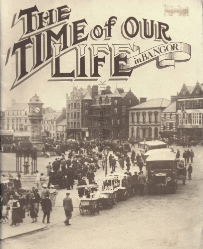

The Time of Our Life in Bangor
Published by The Centenary Committee, Bangor Parish Church, Hamilton Road,
Bangor
Editor Brian W. Parker; Designer Rodney Miller Associates; Printers
Spectator Newspapers Ltd.
Bangor Parish Church 1882 - 1982


Page Two -
Photographs
|